Thursday, August 24, 2017

Hanging with Cowboys in Buffalo, Wyoming

Our spot at the Buffalo KOA "Journey" (apparently there are three different types of KOA's).  $47/night

This is the blog that almost wasn't.  I didn’t plan a blog for this stop since it was just a layover, without a lot of exciting photos.  BUT, this is a great little town and I hope we get to opportunity to visit again and stay longer!   Here's the scoop:

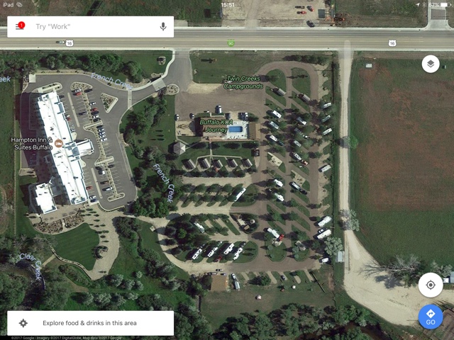
Google Map of our KOA next to a Hampton.  Nice spot to meet up with family

It is a short hop (130 miles) from Devils Tower to Buffalo. Campgrounds with openings are slim in peak season (& not cheap!) as we near Yosemite.  The result is our first KOA (largest chain of privately held campgrounds in the world).  Our scheduled 4 nights became 3 when we stay an extra night at Devil’s Tower (although Buffalo KOA graciously didn't charge us, despite not making the 48-hour notification cutoff).  


It's a nice campground with a clean laundry room adjacent to a back patio for lounging, an outdoor kitchen for gatherings, a game room, and small cabins for rent (Sturgis motorcyclists were taking advantage of these).  We had a shady spot, with only tent campers as close neighbors.  However, it filled up on the weekend (& wifi slowed to a crawl).

My ideal campsite involves a shady spot under the awning & a picnic table.
Bonus: The outdoor power outlet works! What a luxury!
Buffalo is at the crossroads...

Buffalo is at the intersection of I-90 and I-25.  This is the end of our trip on the I-90 corridor.  We'll be heading southbound on I-25 toward Colorado.  This stop also puts us within reach of exploring another National Forest.


The Colonel bike ride #1

The Colonel discovers our location is ideal for some bike riding.  There is a "Strava segment" just outside our campground.  Our elevation is 4646 ft (note he climbed another 1162 & 1179 ft respectively!)

Bike ride #2, "That hurt a little."

Another fun fact for the Longmire fans out there, is the author Craig Johnson lives in the area.  Parts of the fictional town of Durant are based on Buffalo including The Busy Bee.  So I headed out for walk...

This shop was closed, but the window display was fun!

Even though the TV show was filmed in New Mexico, many cast members attend the yearly "Longmire Days".  We just missed it!

The local "bookstore" turned out to be mostly Craig Johnson & CJ Box!

Craig Johnson's list of things to do from Cowboys & Indians magazine, "The Longmire Loop":  http://www.cowboysindians.com/2015/09/the-longmire-loop/ 

C.J. Box is another favorite mystery author whose books are set in Wyoming.  He's from Casper & still lives in the area.


The Busy Bee, next to the Occidental Hotel

This is a genuine "wild west" downtown area, without being touristy/cheesy.  Despite being ON the route to Yosemite, it was hopping with locals in Wrangler's & cowboy hats by happy hour.

The Carnegie Library that inspired Sheriff Longmire's office and a history museum are also here.  Next time!


Wow.  A nice trail system we did not explore enough!

A sculpture dedicated to the Basque


The Bozeman Trail passes through the area

View from Loaf Mountain Overlook (see below for peak names)

On our last day, we decided to take the Cloud Peak Skyway Scenic Byway through the "southern loop" of the Bighorn National Forest. We took 16 West from Buffalo to Ten Sleep then returned. Peak elevation of 9666 ft. Our most scenic stop was the Loaf Mountain Overlook.
(for more info try the WY DOT Scenic Byway brochure: http://www.dot.state.wy.us/files/live/sites/wydot/files/shared/Planning/Big%20Horn%20Scenic%20Byway.pdf)


If you have a full day, they recommend doing "the loop":  16 west to Worland, north to Greybull, then 14 west to Sheridan (Bighorn Skyway?) and back south.


Road conditions driving in the National Forest
We are in the car, but we're always taking note of road conditions.  Could we get Odin the Winnebago up here?  Because there at least are four National Forest campgrounds/dispersed camping locations! 

The answer is yes.  The road is wide sweeping curves with a modest shoulder and rumble strips.  After our stop at Devil’s Tower, we are more seriously scouting stops at National Forests.  The good news is, the ones we saw were dirt roads but near the main road and looked accessible for our Class A.  


USDA Forest Service website is worth checking but not all-inclusive!

There are whole apps/websites dedicated to "boondocking" or camping without hookups.  National Forests are one of the options.  We haven't found it easy to get info on them, but we're learning.  Apparently one of the ways to find these gems, is getting a map of vehicle accessible roads from the park ranger.  

Recreation.gov does reservations for the campgrounds in Bighorn but does not include all dispersed camping options.


And for the finale:  a HUGE ribeye.  Can you say, John Candy's 96 ouncer from Great Outdoors?!

And after seeing real cowboys on horseback herding cattle in the foothills, the boss was in the mood for a steak!

Stay tuned for our final stop in Wyoming--Glendo State Park...

@WyomingTourism @WyoStateParks #ThatsWY  

Friday, August 18, 2017

Hiking Devil's Tower, WY (Pictorial & Maps)

View from our hike on Devils Tower to the valley (& campground) below

Be sure to grab a NPS brochure

NOTE:  The elevation is 3900 ft at the campground (base of these hikes).  You'll need sunscreen or a long-sleeve shirt, hat, eye protection, lots of water (water fountain at visitor’s center), a snack and a trail map.

The start of Tower Trail around the base of Devils Tower

Just us and several hundred bikers...

It's even more stunning up close

At one point, the trail goes right up to the base

Tower Trail (easy, paved, 1.3 miles):  If you want a short hike or are limited on time, then the popular Tower Trail at the Visitor's Center is mandatory.  There are some great views from here.  However, I highly recommend taking the time for one of the two following options:

Start of Hike #1:  Prairie Dog Town

Belle Fourche River or "Pretty Fork River" was named by French fur trappers


The ancient red sandstone cliffs you see from the park entrance

Red Beds trail takes you right along the cliffs.  Wow!

Can you spot The Colonel?


From the Visitor Center trailhead

Hike #1 Red Beds Trail, longer loop (4.1 miles, easy-intermediate)Does not included Tower Trail loop.  See #2.  
Views of Belle Fourche river, the spectacular red sandstone cliffs, Devils Tower and the valley below.  Shallower sections through several meadows. (This side of Devils Tower should look look familiar from the movie, "Close Encounters of the Third Kind".)
  • From the Belle Fourche Campground (see Campground Review blog: camping-at-devils-tower-wy.html), take Valley View Trail along Prairie Dog Town and the Belle Fourche River for 0.6 mi.  
  • Cross the road & head up towards Red Beds Trail 
  • Turn RIGHT on Red Beds Trail for 3 miles. (You’ll have a more gradual climb than turning left and you’ll hike along the red cliff’s with a view down on the valley).  
  • About halfway, you’ll pop out at the Visitor’s Center (Tower Trail is another 1.3).  
  • Continue on Red Beds until you reach the South Side Trail 
  • Then head back down for 0.6 miles, back across the road, through the Prairie Dog Town to the campground.
The two routes through Prairie Dog Town

Pick your direction--left or right


A clearly defined, but single-file trail on hike #2

Hike #2 Red Beds shorter loop with Tower Trail (4.2 miles, intermediate):  
This was the hike we did first, but we both agreed the one above was our favorite.  Spectacular views of the river valley and Devils Tower.
  • From the campground, take the 0.6 miles South Side Trail through the Prairie Dog Town,
  • Cross the road, then climb up to join Red Beds Trail.  (This was the steepest part) 
  • Then turn left for a 0.7 mile more gentle climb than the first segment (but steeper than Hike #1) to the Visitor’s Center (and for us, a COMPLETELY FULL parking lot full of Harley’s).  
  • Tower Trail is a 1.3 mile gently rolling, paved path.  (Total elevation climb from the campground at 3900 ft to 4400 ft). This is fabulous walk because the Tower changes with the light.  There are American Indian prayer flags visible from the path.  You will be able to see several groups of rock climbers.  We saw a white tailed buck, hawk, and bluebird.
  • Return the same route.
NOTE:  While headed out on Hike #2, we ran into a family with two kids (8 & 10?), walking down the main road from the KOA.  We pointed them down to Southside Trail (Hike #1) as the shortest distance to the Visitor's Center.  As we reached the Visitor's Center, I wondered what happened to them.  A short distance later, we found them stopped & enjoying the view.  Their youngest daughter in flip flops, looked tired but was excited and was "glad they came"--although, they were a little disappointed we had caught them already!  So I call it intermediate because of the altitude, and it's not paved, but definitely possible even for kids.  Just stop to take pictures & catch your breath!


Interesting rock formations with a small cave

The intrepid adventurers...(intersection of Valley View & South Side--both hikes)

Option #3, next time:  Valley View, right on Red Beds Trail, Joyner Ridge Trail loop, return. (4.9 miles?)


http://www.mapmyride.com/workout/2385100355

Screenshots from MapMyRide of our hikes.  Click on the links to see more.

http://www.mapmyride.com/workout/2382945227

Reference links:


A good way to find hikes:  mapmyride.com


#FindYourPark @WyomingTourism #ThatsWY @WyoStateParks


Thursday, August 17, 2017

Camping at Devils Tower, WY


Devil's Tower National Monument

For this stop/blog, I recommend 

  • Watching the movie "Close Encounters of the Third Kind" to get in the mood.  It just so happens to be the 40th anniversary!  (After an encounter with U.F.O.s, a line worker feels undeniably drawn to an isolated area in the wilderness where something spectacular is about to happen.  Link for the rerelease trailer on YouTube:  https://youtu.be/dSpQ3G08k48)
  • Download the theme song to play during your hike around the base of the tower or at sunset in the campground 
  • Make mashed potatoes to accompany all of the above (a friend mentioned this on FB & I thought it was brilliant!)
Why Devils Tower? (no apostrophe)  The various Indian names for the landmark include "Bear's Lodge," "Bear's House," "Bear's Tipi," and "Bear Peak".  "Aloft on a Rock" and "Tree Rock."  "Bear Lodge Butte," "Grizzly Bear's Lodge," "Mythic-owl Mountain," "Grey Horn Butte," and "Ghost Mountain."  One version of the story is an interpreter mistakenly calling it "Bad God's Tower".

History:
Devils Tower or Bear Lodge has long been considered a sacred place by the American Indians.  It's believe French fur trappers visited the area, but the first documented white expedition was in 1859 (they were on their way to Yellowstone).  It was designated as a U.S. forest reserve in 1892 and was declared America's first National Monument in 1906 by President Roosevelt.  It's also popular with rock climbers with the first recorded ascent by local ranchers in 1893.  (We could see at least four from every angle.)

It also has an interesting geological history with different theories on it's formation, but you'll have to research that on your own.

A Herbert Collins painting depicting the Cheyenne version of the folklore courtesy NPS.gov

Summary of the story of its creation, 

according to the Akta Lakota Indian Museum:  
A Lakota tribe was traveling through the area 
when several little girls wandered off 
and were surrounded by a pack of hungry bears.  
The girls huddled together on a hill 
as the bears began climbing after them. 
The earth shook and groaned 
as the little knoll, began to rise out of the ground, 
carrying the children high into the air. 
The frustrated bears growled and clawed at its sides. 
Sharp pieces of rock broke away from the rising spire 
and crashed down upon the angry bears.”  (http://aktalakota.stjo.org/site/News2?page=NewsArticle&id=8792)

Example of the road conditions.  Little bumpy.  Devil's Tower in the distance

Devil's Tower is the CoPilot's pick while in the area.  The Belle Fourche campground on the National Park grounds is first-come, first-serve (NO RESERVATIONS), for $20/night!  The KOA just outside the National Park grounds is $60+, a no-go on principle.  As previously mentioned, it's the Sturgis Bike Rally and peak tourist season in the Yosemite/Rushmore corridor but The Colonel agrees to roll the dice.  Alternate?  WalMart parking lot in Gillette.

It’s a short hop across the Wyoming border from Rapid City (110 miles from our campground) with an elevation gain of 1300 ft.  After leaving I-90, it’s 27 miles of winding and hilly road with a narrow shoulder (but still a truck route per our Rand McNally Motor Carriers’ Road Atlas).  It's our most challenging drive yet, with a 9% downhill grade and a peak elevation of 5000 ft.  Based on the number of motorhomes we pass going the other way, we are hopeful.  I'm breathless as the Tower appears in the distance.  

A short line at the entry gate

We arrive at the National Park gate behind a line of Harleys ($15, no NPS senior pass YET).  We are instructed to pull in & unhook the dinghy a mile inside the entrance (for those wanting to continue onto the Visitor’s Center) but this is also the entrance to the campground.

Google Maps view of Belle Fourche

Our favorite pic from this stop

I'm hyper as we unhook {snap, snap, snap—see The Colonel’s fav photo above) and I bolt off in the car to not only find a spot (there were plenty) but to find the BEST spot, which I had studied on Google Earth and reviews (turns out it's not necessary to unhook for navigating the campground).  We end up in a primo spot in Loop A, facing Devil’s Tower with no neighbors except the camphost two spots in front of us.


That's Devils Tower through the trees


Our campground, nestled in the Belle Fourche river

The pull-thrus are big enough for our 36 ft Winnebago, with good views, some shade and are relatively level.  There is no electricity or dump station (there are multiple water spigots but not at each site).  We’re basically dry camping or "boondocking", but it’s 79F with 29% humidity and a light breeze.  The quandry is, without electricity, do you want shade to keep cool?  Or sunlight for our solar panel?  We compromise (we run the generator for 30 min before sunset.  It's a nervous night, since our generator will auto-start if the batteries get low and that's a no-no during quiet hours!)  The good news is, we awoke to the same 12.6 we went to bed with.

Another view our spot

You pay on honor system but the Camphost and Park Rangers make regular rounds, so be honest!  (The Colonel took down our slip as we prepped to leave & the Camphost stopped to ask for it...)  We originally paid for one night but we ended up staying two.  We drove all this way after all!  

Our moderate shade, the trees will effect your view

We still aren't the biggest RV in the campground.  Including us there are 4 class A’s, and three fifth wheels.  The rest of the 50 campsites were tent & van campers.  The first night was full was late afternoon, but that didn't stop a few people from driving through after dark.  (The second night did not appear full & was mostly tent campers).

Prairie Dog's keeping a close eye on us

To do:

  • Visitor’s Center:  The parking lot was full of Harley's so we didn't stop
  • Prairie Dog Town:  Dang they're cute & make a funny chatter as you walk by.  This was a popular turnout with the Harley's
  • Hike:  (stay tuned for a link) There turned out to be some great hikes from the campground but we met people who hiked from the KOA! 
  • Nothing:  This was a very quiet, peaceful campground and aside from the distant hum of motorcycles during the day, it couldn't have been darker or quieter at night!

A view from the trail that starts at the campground (Prairie Dog Town)

Summary
This stop is difficult to explain.  Even The Colonel acknowledged there is a different vibe here.  The Indians believe it is a spiritual place and we'd have to agree.  Everything from the fact that I had trouble sleeping at night because I felt wide awake to the incredibly clear pictures I took with my iPhone.  It's difficult to describe.  If you didn't spend the night on the grounds, you'd be missing a part of the magic.  It's also a truly unique geographical feature that is even more spectacular in person.

If nothing else, this stop has inspired The Colonel to add another solar panel or two.  If the temps are reasonable, and we keep the stops to 5 days or less, more extreme boondocking is closer to reality for us.  (Watch for our stop at Glendo State Park!)

Stay tuned for our hikes around Devils Tower!

References:
NPS:  https://www.nps.gov/deto/index.htm
Akta Lakota:  http://aktalakota.stjo.org/site/News2?page=NewsArticle&id=8792
Wikipedia:  https://en.wikipedia.org/wiki/Devils_Tower

@WyomingTourism #ThatsWY @WyoStateParks