Hello friends! We are currently back on the boat in St. Thomas, USVI.
Since Blogger no longer supports their iphone/ipad app, and their website is incompatible with tablet browers, I am experimenting with migrating the blog over to Wordpress.
Check us out at: https://planesboatsandbicycles.wordpress.com/
We are also active on our FaceBook page: @svodinthewanderer
Thursday, February 15, 2018
Tuesday, October 3, 2017
Navigation in an RV
 |
| Here is your Bible. When all else fails, follow a trucker... |
Nothing ignites a fire storm in a RV forum like "which GPS/navigation system do you use?" The most common are Garmin, Rand McNally & Magellan. Others claim only an atlas is reliable. Many are stuck with what came installed in their RV. A friend's recommendation was make sure it gives advance turn instructions & shows you WHICH LANE you should be in! The best of course is a trucker's GPS (more expensive). However, after doing research and not being able to decide, here's what we cobbled together in the beginning & it still works. I haven't been able to justify spending more money.
DISCLAIMER: As pilots and sailors, we can honestly tell you, NEVER TRUST YOUR GPS OVER YOUR EYEBALLS & YOUR GUT. Stop. Pull over. Unhook the dinghy & drive ahead if you have to. All the good stories start with the little voice saying, "I don't like it..." There are plenty of stories about a GPS attempting to turn people off a snow-covered cliff. Your only mistake will be trusting one source of information.
Start with preliminary planning: zoom in on the route in Google Maps and consult an atlas. Have two reliable GPS programs running while driving (we feel slightly more relaxed when they agree). You can still get bad information. (No one from Google Maps will come out to help you unhook, then back up that narrow road with no shoulders. IT'S OUR HOUSE!). I have found no one source of navigation info that is perfect. Every forum is full of people giving examples why they'll never use "X" again. Most importantly, you have to be comfortable with what you are using--load it up on days you don't need it so you're comfortable with the nuances (I prefer that Odin the Sailboat or Winnebago doesn't start moving until we both agree with what is entered, but $hit happens...) Also, the GPS is primarily for navigation. We use a variety of apps to find campgrounds, fuel stops & rest areas. Don't even bother trying to find a GPS that does it all. It doesn't exist.
Start with preliminary planning: zoom in on the route in Google Maps and consult an atlas. Have two reliable GPS programs running while driving (we feel slightly more relaxed when they agree). You can still get bad information. (No one from Google Maps will come out to help you unhook, then back up that narrow road with no shoulders. IT'S OUR HOUSE!). I have found no one source of navigation info that is perfect. Every forum is full of people giving examples why they'll never use "X" again. Most importantly, you have to be comfortable with what you are using--load it up on days you don't need it so you're comfortable with the nuances (I prefer that Odin the Sailboat or Winnebago doesn't start moving until we both agree with what is entered, but $hit happens...) Also, the GPS is primarily for navigation. We use a variety of apps to find campgrounds, fuel stops & rest areas. Don't even bother trying to find a GPS that does it all. It doesn't exist.
 |
| The roads with orange highlight are trucker friendly |
Truckers' Atlas: We originally purchased the National Geographic Road Atlas from Camping World. It’s helpful for an overview during longer trips, but mostly useless. Buy the Rand McNally Deluxe Motor Carriers’ Road Atlas. If the trucker’s can do it, you should be able to also. (We love following a semi onto roads we’re unsure about). It means there shouldn’t be any width, height or weight restrictions or turns we can’t handle. Highways highlighted in amber are a “designated route for authorized dimensions". The pages are laminated to withstand use & abuse. Did you know the minimum width for highways changes from state to state? (96'-108'). And height also? (13'-15'). The truckers' atlas has a table in the front by state. It's also handy for finding state parks & national forests we want to visit. Our National Geographic Atlas gathers dust. We pull out the Trucker's Atlas daily while on the move. (Many Visitor's Centers still give our State Maps--handy to have in a pinch. A State Atlas is also handy, much this can get expensive if you travel extensively)
Check for construction: While doing your planning the night before, check each state’s DOT website or call 511. A lot of times, there is nothing you can do about construction areas, except be aware of them (and make sure The Colonel is driving during the majority of them & not me!). However, it may add more time or affect for lunch stop for the day. Sometimes, you may be able to route around. (The truckers' atlas has a list of the DOT websites.)
 |
| AmazonBasics-3-5mm-Stereo-Audio-Cable/dp/B00NO73MUQ/ref=sr_1_1?ie=UTF8&qid=1507045829&sr=8-1&keywords=3.5+mm+male+to+male |
Marriage Saver (or driving solo): I highly recommend an app or GPS that gives voice prompts. I only have to load our destination, double check the routing matches the atlas, then monitor & give occasional “2 hours out”. Don’t like your voice prompts? That's between you and Bitching Betty!
If you look closely at your dash stereo and see an tiny aux input (about the size for headphones) then I HIGHLY recommend getting a 3.5 mm male to male stereo audio cable. This runs the audio from our primary navigation iPad, straight through the dash speakers so the driver can clearly hear the voice directions and control the volume. When properly set up, it will also mute any music for the voice prompts.
If you look closely at your dash stereo and see an tiny aux input (about the size for headphones) then I HIGHLY recommend getting a 3.5 mm male to male stereo audio cable. This runs the audio from our primary navigation iPad, straight through the dash speakers so the driver can clearly hear the voice directions and control the volume. When properly set up, it will also mute any music for the voice prompts.
 |
| Google Maps |
Google Maps: This is good for initial planning (& the primary in the car) BUT it has limitations for RV navigation:
- It always takes the shortest route (sometimes it "appears" to give you options) but it will REROUTE from your original planned route if it sees a slow down ahead.
- It uses lot’s of secondary roads and doesn’t recognize height/width/weight restrictions.
- The travel time is based on speed limit (the speed limit in South Dakota is 80!) not our normal 62 for fuel mileage.
- If you lose cell service, it will quit working! You can download small areas for offline use (check out the blog on how to do that here: cheapskates-on-move-saving-data-offline.html) but it expires every 30 days and of course, you may not know you need it and then YOU CAN'T DOWNLOAD (good for driving through the Mt Rushmore area, for example. Use Bad Elf for location when there’s no cell service—see below)
- We use Google Maps satellite view during planning to zoom in and look at the route (is that a two-lane or 4-lane divided highway?)
- As a backup in the RV (on one of our iPhones)
- For searching for fuel stops or rest areas without disrupting our primary navigation app (type in “rest area” or “rest stop”).
(A stand-alone GPS: We don't use a stand-alone GPS. They range in price from $300 on up and they get TERRIBLE reviews. With aviation backgrounds, we'd normally lean towards Garmin. However, with two iPads onboard with big beautiful screens, we have found they work just as well. The initial intention was to have a screen where the driver could see it, but we quickly learned the voice prompts are most important for the driver. The copilot monitors the on-screen map. Also the stand-alones are not user-friendly when it comes to updating the database or downloading additional maps.)
 |
| Our primary navigation app |
CoPilot RV USA: This is an iPad app we originally purchased for $35 (I believe the price is slightly higher now). It is our Primary navigation because:
- It has downloaded/offline maps
- Allows you to add your RV dimensions so it can check for for restrictions along your route (low bridges, narrow road construction, bridges with weight restrictions)
- You can select preferred roads for routing (ie. interstate/highway are primary, then secondary roads, etc).
- When you are nearing an exit, it switches to a screen with a diagram of the exit lanes.
- You can adjust the route by “skip road” or adding a fuel stop.
- Easy to update the database & download additional maps.
Disadvantages:
- It gives you more voice prompts than necessary. ("Two miles ahead, continue straight when Highway 36 splits off...") These are usually exits, so you wouldn't normally worry about being in the correct lane. It doesn't bother me. The Colonel doesn't like it.
- It quits talking when it doesn’t know it's GPS location (even with maps downloaded), SO we are very careful to listen for voice prompts as we initially navigate out of the campground.
- During your initial loading of route, you need to zoom in & out with the +/- arrows (it would be nice if you could confirm the route by zooming in & out with the touch screen)
- You need a GPS capable iPhone/iPad OR other source of GPS location data--see Bad Elf below.
 |
| Google Maps without GPS information |
 |
| Google Maps with GPS information |
Bad Elf Pro: Wifi only iPads do not have an internal GPS chip (Pilots have been using Bad Elf in flight for over 5 years--here's a great explanation of iPad requirements you need to navigate an RV or airplane: https://www.foreflight.com/support/faqs/gps/). Without a built-in GPS, Google Maps & CoPilot won't know your exact position. We bought the Bad Elf Pro after I had a brain fart and bought a wifi only iPad. Friends used the Bad Elf to navigate from the Bahamas to Grenada on their boat. It's also handy when you are in a “No Service” areas like National parks that don’t have cell phone towers. It also doesn’t use cellular data. It is relatively simple to use if bluetooth doesn't scare you. (Also good for remote hikes when my MapMyRide app doesn't have any cell service.)
 |
| Anker 12-v car charger. One in the car & one in the RV |
12v car charger: with 2 USB ports (for your primary & secondary navigation devices or Bad Elf because “house” outlets don’t work while driving unless you start the generator). I like this Anker—without getting too technical, some chargers only trickle charge and will not provide enough juice to charge while you are using a navigation app (you need 2.1 amps/port or 4.2 amps minimum for the 2 port pictured above).
Navigation in the Dinghy: One disadvantage of being a full-time nomad is simple chores aren’t simple. Buying groceries and doing laundry are good examples. Where’s the grocery store? Is there more than one? Can we stop on the way in with the RV? A laundromat at an RV park is preferred, occasionally a State Park will have a laundry room but usually it involves a run into town. This means a second navigation source for the dinghy/tow car.
For solo laundry & grocery runs in a new town, I use Google Maps on my iPhone (download the area for offline use, if needed—McDonald’s or truck stop on the way in), with volume set to “Louder” (settings, Guidance Volume, LOUDER. Also, “Play voice over Bluetooth” if you have that capability.). We have a dedicated 12 volt phone charger in the car (because after a couple errands, you may not be able to find the most direct route back!). I also recommend an audio cable so you can hear the voice prompts through the dashboard speakers—see above, Marriage Saver).
Phew! Did you get all that? Of course all this tech changes every year. Let me know your favorite way to navigate...
Tuesday, September 5, 2017
Hurricane Irma. Hurricane Warning for Puerto Rico
 |
| Our home base in northeastern Fajardo, Puerto Rico |
We are safe in our RV in Colorado. Our boat is insured. When we left the boat in storage in June, it was prepped for a hurricane. We monitor the Caribbean weather daily. We’ve been watching Irma since it was in the mid-Atlantic. We've experienced a low-wind Tropical Storm & 70 kts at anchor, but this is our first time in the path of a hurricane.
 |
| Dry boat storage at Puerto del Rey |
Irma's track has been adjusted south this morning and Puerto Rico has officially activated emergency hurricane plans. We are officially freakin worried about our home island, that floods when it rains...
“...IRMA BECOMES AN EXTREMELY DANGEROUS
CAT 5 HURRICANE...
MAXIMUM SUSTAINED WINDS...175 MPH...280 KM/H…
Hurricane-force winds extend outward
up to 45 miles (75 km) from the center
and tropical-storm-force winds extend outward
up to 140 miles
(220 km)…”
 |
| NOAA wind forecast |
Our hurricane plan: s/v Odin is in dry storage at Puerto del Rey, Fajardo, Puerto Rico. She's stripped and strapped down. We chose Puerto del Rey because it is largely considered one of the safest storage yards in the Caribbean and is approved by our insurance company.
“Puerto Del Rey Marina provides excellent
protection from hurricanes for
mono-hull and catamarans.
Underground hurricane-proof steel and
cement structures are protected from the sea
by 100,000 square meters of US NAVY
controlled mangrove. A block-and-jack-stand
support system is used within a
network of strong tie-down points.”
 |
| Our location in the yard, back row next to a large powerboat |
Hurricane monitoring: We receive Chris Parker & NOAA weather forecast emails daily. When there is a threat, we monitor the NOAA Tropical Storm Forecast every 6 hours. There are several other websites that we follow also.
 |
| Officially the strongest hurricane in the Atlantic Basin |
Hurricane Hugo: Hurricane Hugo is the most talked about weather event in Puerto Rico. It was part of the criteria when we chose our storage facility. It was a Cat 5 approaching the islands, Cat 4 over St. Croix and a Cat 3 when it reached Puerto Rico (Cat 4 damage recorded on the ground). You can read more here:
Sailors may remember that Hurricane Hugo is the storm that took Fatty Goodlander's boat Carlotta, while anchored in Culebra, Puerto Rico. You can read an excerpt here:
Latest Chris Parker forecast: N PR near SanJuan: ENE<NE@7-15<15-20k Today; then NE<N@15-20g25k overnight-Wed6 morning N@15-30<W@50-70k<SW@40-70k Seas 25-35’ Storm Surge 6-10’ Wed6 afternoon-Wed6 midnight; SW<S@40-70<S@30k Late Wed6 night-Thu7 morning then similar to Guadeloupe-Leewards Thu7 onward.
Webcams:
Puerto del Rey: http://www.puertodelrey.com/en/boatyard-storage
Links:
Chris Parker
NOAA Hurricane: http://www.nhc.noaa.gov/
Puerto del Rey: http://www.puertodelrey.com/en/boatyard-storage
Tuesday morning forecast, NOAA Hurricane Center, Public Advisory: (http://www.nhc.noaa.gov/text/refresh/MIATCPAT1+shtml/051742.shtml?)
000
WTNT31 KNHC 051159
TCPAT1
Hurricane Irma Special Advisory Number 25
NWS National Hurricane Center Miami FL AL112017
800 AM AST Tue Sep 05 2017
...IRMA BECOMES AN EXTREMELY DANGEROUS CATEGORY 5 HURRICANE...
...PREPARATIONS SHOULD BE RUSHED TO COMPLETION IN THE HURRICANE
WARNING AREA...
SUMMARY OF 800 AM AST...1200 UTC...INFORMATION
----------------------------------------------
LOCATION...16.7N 57.7W
ABOUT 270 MI...440 KM E OF ANTIGUA
ABOUT 280 MI...445 KM ESE OF BARBUDA
MAXIMUM SUSTAINED WINDS...175 MPH...280 KM/H
PRESENT MOVEMENT...W OR 280 DEGREES AT 14 MPH...22 KM/H
MINIMUM CENTRAL PRESSURE...929 MB...27.44 INCHES
WATCHES AND WARNINGS
--------------------
CHANGES WITH THIS ADVISORY:
The government of the Dominican Republic has issued a Hurricane
Watch from Cabo Engano to the northern border with Haiti and a
Tropical Storm Watch from south of Cabo Engao to Isla Saona.
SUMMARY OF WATCHES AND WARNINGS IN EFFECT:
A Hurricane Warning is in effect for...
* Antigua, Barbuda, Anguilla, Montserrat, St. Kitts, and Nevis
* Saba, St. Eustatius, and Sint Maarten
* Saint Martin and Saint Barthelemy
* British Virgin Islands
* U.S. Virgin Islands
* Puerto Rico, Vieques, and Culebra
A Hurricane Watch is in effect for...
* Guadeloupe
* Dominican Republic from Cabo Engano to the northern border with
Haiti
A Tropical Storm Warning is in effect for...
* Guadeloupe
* Dominica
A Tropical Storm Watch is in effect for...
* Dominican Republic from south of Cabo Engao to Isla Saona
A Hurricane Warning means that hurricane conditions are expected
somewhere within the warning area. A warning is typically issued
36 hours before the anticipated first occurrence of tropical-storm-
force winds, conditions that make outside preparations difficult or
dangerous. In this case, for some of easternmost islands, the
hurricane conditions are expected within the next 24 hours.
Preparations to protect life and property should be rushed to
completion.
A Tropical Storm Warning means that tropical storm conditions are
expected somewhere within the warning area in this case within 36
hours.
A Tropical Storm Watch means that tropical storm conditions are
possible within the watch area, generally within 48 hours.
Interests elsewhere in the Dominican Republic, along with Haiti,
the Turks and Caicos Islands, Cuba, and the southeastern and central
Bahamas should monitor the progress of Irma.
For storm information specific to your area in the United
States, including possible inland watches and warnings, please
monitor products issued by your local National Weather Service
forecast office. For storm information specific to your area outside
the United States, please monitor products issued by your national
meteorological service.
DISCUSSION AND 48-HOUR OUTLOOK
------------------------------
At 800 AM AST (1200 UTC), the distinct eye center of Hurricane Irma
was located near latitude 16.7 North, longitude 57.7 West. Irma is
moving toward the west near 14 mph (22 km/h), and this general
motion is expected to continue today, followed by a turn toward the
west-northwest tonight. On the forecast track, the dangerous core of
Irma will move near or over portions of the northern Leeward Islands
tonight and early Wednesday.
Reports from NOAA and U.S. Air Force Hurricane Hunter aircraft
indicate Irma continues to strengthen and maximum sustained winds
have increased to near 175 mph (280 km/h) with higher gusts. Irma
is an extremely dangerous category 5 hurricane on the Saffir-Simpson
Hurricane Wind Scale. Some fluctuations in intensity are likely
during the next day or two, but Irma is forecast to remain a
powerful category 4 or 5 hurricane during the next couple of days.
Hurricane-force winds extend outward up to 45 miles (75 km) from the
center and tropical-storm-force winds extend outward up to 140 miles
(220 km).
The latest estimated minimum central pressure from aircraft data is
929 mb (27.44 inches).
HAZARDS AFFECTING LAND
----------------------
STORM SURGE: The combination of a dangerous storm surge and large
breaking waves will raise water levels by as much as 7 to 11 feet
above normal tide levels along the coasts of the extreme northern
Leeward Islands within the hurricane warning area near and to the
north of the center of Irma. Near the coast, the surge will be
accompanied by large and destructive waves.
The combination of a dangerous storm surge and the tide will cause
normally dry areas near the coast to be flooded by rising waters
moving inland from the shoreline. The water is expected to reach
the following heights above ground if the peak surge occurs at the
time of high tide...
British and U.S. Virgin Islands except St. Croix...7 to 11 ft
Northern coast of Puerto Rico...2 to 4 ft
Southern coast of Puerto Rico and St. Croix...1 to 2 ft
The deepest water will occur along the immediate coast in areas of
onshore winds, where the surge will be accompanied by large and
destructive waves. Surge-related flooding depends on the relative
timing of the surge and the tidal cycle, and can vary greatly over
short distances. For information specific to your area, please see
products issued by your local National Weather Service forecast
office.
WIND: Hurricane conditions are expected within the hurricane
warning area in the Leeward Islands by tonight, with tropical storm
conditions beginning later today. Tropical storm conditions are
expected within the tropical storm warning area where hurricane
conditions are also possible. Hurricane conditions are expected
to begin within the hurricane warning area in the British and U.S.
Virgin Islands and Puerto Rico on Wednesday, with tropical storm
conditions beginning tonight. Hurricane and tropical storm
conditions are possible within the watch area in the Dominican
Republic by early Thursday.
RAINFALL: Irma is expected to produce total rainfall accumulations
of 4 to 8 inches with isolated maximum amounts of 12 inches across
the northern Leeward Islands, the British and U.S. Virgin Islands,
and Puerto Rico. These rainfall amounts may cause life-threatening
flash floods and mudslides.
SURF: Swells generated by Irma will affect the northern Leeward
Islands, Puerto Rico, and the U.S. and British Virgin Islands
during the next several days. These swells are likely to cause
life-threatening surf and rip current conditions. Please consult
products from your local weather office.
Thursday, August 24, 2017
Hanging with Cowboys in Buffalo, Wyoming
 |
| Our spot at the Buffalo KOA "Journey" (apparently there are three different types of KOA's). $47/night |
This is the blog that almost wasn't. I didn’t plan a blog for this stop since it was just a layover, without a lot of exciting photos. BUT, this is a great little town and I hope we get to opportunity to visit again and stay longer! Here's the scoop:
 |
| Google Map of our KOA next to a Hampton. Nice spot to meet up with family |
It is a short hop (130 miles) from Devils Tower to Buffalo. Campgrounds with openings are slim in peak season (& not cheap!) as we near Yosemite. The result is our first KOA (largest chain of privately held campgrounds in the world). Our scheduled 4 nights became 3 when we stay an extra night at Devil’s Tower (although Buffalo KOA graciously didn't charge us, despite not making the 48-hour notification cutoff).
It's a nice campground with a clean laundry room adjacent to a back patio for lounging, an outdoor kitchen for gatherings, a game room, and small cabins for rent (Sturgis motorcyclists were taking advantage of these). We had a shady spot, with only tent campers as close neighbors. However, it filled up on the weekend (& wifi slowed to a crawl).
 |
| My ideal campsite involves a shady spot under the awning & a picnic table. Bonus: The outdoor power outlet works! What a luxury! |
 |
| Buffalo is at the crossroads... |
Buffalo is at the intersection of I-90 and I-25. This is the end of our trip on the I-90 corridor. We'll be heading southbound on I-25 toward Colorado. This stop also puts us within reach of exploring another National Forest.
 |
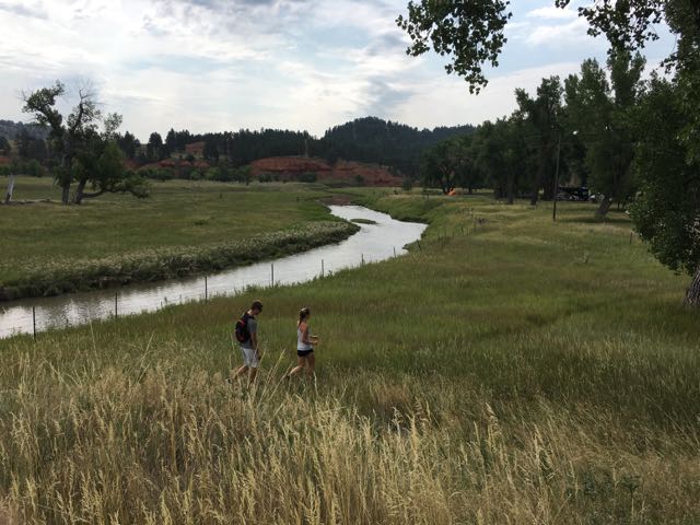
| The Colonel bike ride #1 |
The Colonel discovers our location is ideal for some bike riding. There is a "Strava segment" just outside our campground. Our elevation is 4646 ft (note he climbed another 1162 & 1179 ft respectively!)
 |
| Bike ride #2, "That hurt a little." |
Another fun fact for the Longmire fans out there, is the author Craig Johnson lives in the area. Parts of the fictional town of Durant are based on Buffalo including The Busy Bee. So I headed out for walk...
 |
| This shop was closed, but the window display was fun! |
Even though the TV show was filmed in New Mexico, many cast members attend the yearly "Longmire Days". We just missed it!
 |
| The local "bookstore" turned out to be mostly Craig Johnson & CJ Box! |
Craig Johnson's list of things to do from Cowboys & Indians magazine, "The Longmire Loop": http://www.cowboysindians.com/2015/09/the-longmire-loop/
C.J. Box is another favorite mystery author whose books are set in Wyoming. He's from Casper & still lives in the area.
 |
| The Busy Bee, next to the Occidental Hotel |
This is a genuine "wild west" downtown area, without being touristy/cheesy. Despite being ON the route to Yosemite, it was hopping with locals in Wrangler's & cowboy hats by happy hour.
The Carnegie Library that inspired Sheriff Longmire's office and a history museum are also here. Next time!
 |
| Wow. A nice trail system we did not explore enough! |
 |
| A sculpture dedicated to the Basque |

 |
| The Bozeman Trail passes through the area |
 |
| View from Loaf Mountain Overlook (see below for peak names) |
On our last day, we decided to take the Cloud Peak Skyway Scenic Byway through the "southern loop" of the Bighorn National Forest. We took 16 West from Buffalo to Ten Sleep then returned. Peak elevation of 9666 ft. Our most scenic stop was the Loaf Mountain Overlook.
(for more info try the WY DOT Scenic Byway brochure: http://www.dot.state.wy.us/files/live/sites/wydot/files/shared/Planning/Big%20Horn%20Scenic%20Byway.pdf)

If you have a full day, they recommend doing "the loop": 16 west to Worland, north to Greybull, then 14 west to Sheridan (Bighorn Skyway?) and back south.
 |
| Road conditions driving in the National Forest |
The answer is yes. The road is wide sweeping curves with a modest shoulder and rumble strips. After our stop at Devil’s Tower, we are more seriously scouting stops at National Forests. The good news is, the ones we saw were dirt roads but near the main road and looked accessible for our Class A.
 |
| USDA Forest Service website is worth checking but not all-inclusive! |
There are whole apps/websites dedicated to "boondocking" or camping without hookups. National Forests are one of the options. We haven't found it easy to get info on them, but we're learning. Apparently one of the ways to find these gems, is getting a map of vehicle accessible roads from the park ranger.
 |
| Recreation.gov does reservations for the campgrounds in Bighorn but does not include all dispersed camping options. |
 |
| And for the finale: a HUGE ribeye. Can you say, John Candy's 96 ouncer from Great Outdoors?! |
And after seeing real cowboys on horseback herding cattle in the foothills, the boss was in the mood for a steak!
Stay tuned for our final stop in Wyoming--Glendo State Park...
@WyomingTourism @WyoStateParks #ThatsWY
Friday, August 18, 2017
Hiking Devil's Tower, WY (Pictorial & Maps)
 |
| View from our hike on Devils Tower to the valley (& campground) below |
 |
| Be sure to grab a NPS brochure |
NOTE: The elevation is 3900 ft at the campground (base of these hikes). You'll need sunscreen or a long-sleeve shirt, hat, eye protection, lots of water (water fountain at visitor’s center), a snack and a trail map.
 |
| The start of Tower Trail around the base of Devils Tower |
 |
| Just us and several hundred bikers... |
 |
| It's even more stunning up close |
 |
| At one point, the trail goes right up to the base |
Tower Trail (easy, paved, 1.3 miles): If you want a short hike or are limited on time, then the popular Tower Trail at the Visitor's Center is mandatory. There are some great views from here. However, I highly recommend taking the time for one of the two following options:
 |
| Start of Hike #1: Prairie Dog Town |
 |
| Belle Fourche River or "Pretty Fork River" was named by French fur trappers |

 |
| The ancient red sandstone cliffs you see from the park entrance |
 |
| Red Beds trail takes you right along the cliffs. Wow! |
 |
| Can you spot The Colonel? |
 |
| From the Visitor Center trailhead |
Hike #1 Red Beds Trail, longer loop (4.1 miles, easy-intermediate): Does not included Tower Trail loop. See #2.
Views of Belle Fourche river, the spectacular red sandstone cliffs, Devils Tower and the valley below. Shallower sections through several meadows. (This side of Devils Tower should look look familiar from the movie, "Close Encounters of the Third Kind".)
- From the Belle Fourche Campground (see Campground Review blog: camping-at-devils-tower-wy.html), take Valley View Trail along Prairie Dog Town and the Belle Fourche River for 0.6 mi.
- Cross the road & head up towards Red Beds Trail
- Turn RIGHT on Red Beds Trail for 3 miles. (You’ll have a more gradual climb than turning left and you’ll hike along the red cliff’s with a view down on the valley).
- About halfway, you’ll pop out at the Visitor’s Center (Tower Trail is another 1.3).
- Continue on Red Beds until you reach the South Side Trail
- Then head back down for 0.6 miles, back across the road, through the Prairie Dog Town to the campground.
 |
| The two routes through Prairie Dog Town |
 |
| Pick your direction--left or right |

 |
| A clearly defined, but single-file trail on hike #2 |
Hike #2 Red Beds shorter loop with Tower Trail (4.2 miles, intermediate):
This was the hike we did first, but we both agreed the one above was our favorite. Spectacular views of the river valley and Devils Tower.
- From the campground, take the 0.6 miles South Side Trail through the Prairie Dog Town,
- Cross the road, then climb up to join Red Beds Trail. (This was the steepest part)
- Then turn left for a 0.7 mile more gentle climb than the first segment (but steeper than Hike #1) to the Visitor’s Center (and for us, a COMPLETELY FULL parking lot full of Harley’s).
- Tower Trail is a 1.3 mile gently rolling, paved path. (Total elevation climb from the campground at 3900 ft to 4400 ft). This is fabulous walk because the Tower changes with the light. There are American Indian prayer flags visible from the path. You will be able to see several groups of rock climbers. We saw a white tailed buck, hawk, and bluebird.
- Return the same route.

 |
| Interesting rock formations with a small cave |
 |
| The intrepid adventurers...(intersection of Valley View & South Side--both hikes) |
Option #3, next time: Valley View, right on Red Beds Trail, Joyner Ridge Trail loop, return. (4.9 miles?)
 |
| http://www.mapmyride.com/workout/2385100355 |
Screenshots from MapMyRide of our hikes. Click on the links to see more.
 |
| http://www.mapmyride.com/workout/2382945227 |
Reference links:
Another hiking website with maps: https://www.hikingproject.com/trail/7012726/red-beds-trail
A good way to find hikes: mapmyride.com
#FindYourPark @WyomingTourism #ThatsWY @WyoStateParks
Subscribe to:
Posts (Atom)