Sunday, January 31, 2016

Dear Diary (week 3 Georgetown)

Full Moon in the anchorage

I recall our last week in Georgetown as very boring and not worthy of a blog post. However, as I looked back at what I wrote, I decided to share it for continuity. Be patient. WE ARE PREPPING TO DEPART GEORGETOWN!

Study, study, study.

Day 15 Fri, Jan 22: The Captain walks over the hill to refill propane at BEC ($10 for 11 lb is the cheapest in town).  The winds are forecast to kick up and clock around again, so we're hunkered down. The boat count for the season is 178, down from 262 (400 at a peak). Our little anchorage swells from one to nine.  Chartbooks come out. Winds shifted south but not 20 kts yet. 

Day 16 Sat, Jan 23: The winds swung to the west overnight at less than 10. We slept like babies except for the short rain shower that meant I had rollover & close a hatch. The winds were so calm that when the Captain popped his head out, he's disoriented. "Did somebody move?"  Nope.  We both hate to think it. Should we run into town?  We'd like to be ready to jump to Long Island in the next weather window. We risk it and make it back, no worse for wear so The Captain makes a second run for water.  By noon, there is an occasional gust to 25, but the sun is out. Dinghies and multiple kayaks are in the water. Someone is snorkeling. A few boats are "shuffling". It's chat n chill west in our tiny anchorage. .(Seriously. I guess part of the appeal of Georgetown is moving anchorages with the wind, but we prefer to find a spot & stay put--our anchor is buried nicely!).  

We hear from friends that there is a good grocery store, water and fuel at Thompson Bay, Long Island. A long weather discussion ensues and I'm counting the days until we can move on. We're both getting a little testy.  Chris Parker has reported the trade winds are light for this time of year. Everyone keeps telling us how weird the weather is compared to usual. The evening email says the trend should change:  "February should bring a rapid & significant change to weather pattern...we'll continue seeing about 1 ColdFRONT every 6-7 days...but LOs will form & track farther N...and we'll see N<ENE winds behind FRONTs (instead of W<N)...and more days with ENE<ESE Trades and settled weather between FRONTs - a rather typical winter pattern. Sure, there will still be on average 1-2 days each week you may need to "hide", but that's better than 3-5 days/week of inclement weather we've seen for much of January."

By moon rise (it's a full moon!) the boat is gently rocking from the wind. I stay up late after a cold-brew ice coffee--until almost 9!  We've started watching Justified on DVD, then download some Elmore Leonard books. It's chilly, so I close hatches and dig out some socks to go with the flannel jammies then unroll the blanket. Cuddling tonight! 

Day 17, Jan 24:  I'm up at 4:00 am. The wind is a steady 20-25 kts and the sloshing and squeaking of the boat drags me into the cockpit to check on things. I might as well make coffee. The cat can't tell time. 4:00 am.  6:00 am. Mom is up. Let's eat!

We passed the Shedd Aquarium (Chicago) rv Coral Reef II which was docked downtown the other day. A quick google revealed 1) I haven't found a single conch salad since we've arrived, apparently because the Queen Conch population is near collapse from overfishing 2). Part of the reason for near extinction of the lizards is junk food from the tourists!  Don't feed the lizards!  Learn more here: http://www.sheddaquarium.org/Conservation--Research/Field-Research/Around-the-Globe/Studying-Iguanas-in-the-Bahamas/

Another beautiful sunrise in Georgetown, S of Goat Cay

Day 18, Jan 25:  Freedom!  The winds let up. Another morning discussion about weather and the First Mate convinces the Captain to anchor downtown for at least one day to provision up. With the First Mate at the helm (because raising and lowering the anchor is "exhausting"), we cruise down the Georgetown shore instead of going back out to the channel. We scoot over to the southern side of Kidd Cove trying to avoid the crowds & crazy dinghy traffic. By the time we hit the dinghy dock, there is a LONG line for water. I hop off and head to the grocery store while The Captain waits in line, then runs it back out to the boat.  Since Peace and Plenty provides free wifi, we go for lunch on their patio. We chat with some Canadians at the next table, who saw our boat pass by from their patio this morning.  A quick stop at the the liquor store for more coconut rum and Kalik.  "Bottles or cans?"  "You have cans?!"  We almost can't extracate ourselves from the dinghy dock.

Now who would expect a line for water on Monday morning after a forecast 3-day blow?

Returning to the boat, the harbor is in full "shuffle" mode.  One neighbor has left and another has arrived.  The wind has also shifted west, then gone calm, so our anchor chain has a loop in it and we've passed over the anchor!  We are at low tide and the depth sounder reads 5.3, so I jump in for a quick snorkel. It's a little chilly, but I check on our anchor and the abandoned mooring lying on the bottom next to us.  Anxious for some exercise I request the scraper. I get 3/4 of the boat done including between the hulls and lower than I can usually reach.  I had tossed the flippers back on deck because the water is so shallow, I can almost stand and walk with my snorkel--so I didn't get the keels. I rinse off and wash my hair on the stern steps.  The Captain has cut open our second coconut, so I'm greeted with a rum punch & coconut meat.

Where is the world is our anchor?  Not over there!


3 more days. 

Day 19 Jan 26:  Grocery run. Bank. Liquor store. 

You never know who you'll be anchored next to (note the roller furling sails & the dolphin!)

Day 20 Jan 27:  Laundry run.  Grocery.  Red Boone.  Chat with Dos Libras about their southbound plans. 


After 20 days, it's time to leave Georgetown. I felt a little claustrophobic as soon as we pulled into the harbor. Chat n chill anchorage still makes me cringe. Yes, it's nice to have access to a 2 groceries and a meat market, free water, two laundromats, a vet, unlimited wifi and numerous anchoring options. We've met a lot of nice people. You can't walk from the dinghy dock to Red Boone without running into old friends or meeting new ones. We haven't fully covered all the activities here--we never even stepped foot into Chat n Chill. (Don't tell anyone!). However, we are ready to be out on the water exploring somewhere new. Yes, it's a five mile stretch down the harbor that can justify a motor sail. Yes, there are anchorages we haven't tried. Plenty of trails & restaurants to keep us busy. However, the lure of the Turks & Dominican pulls us forward. We bought a few more guidebooks (thank you sv Shoestring).  We sold our East Coast charts and guidebooks (good luck sv Puffin).  We're talking through all the stops. It's sad to leave our friends, but many are starting to plan their trips back north.

Wednesday, January 27, 2016

We have a visitor!

Anchored "South of Goat Cay" in front of Augusta Bay Resort

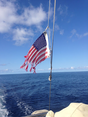
Georgetown Day 9, our guest arrives (Sat Jan 16):  A girlfriend is coming to visit! A girlfriend is coming to visit! Luckily, spring cleaning on our tiny home only takes 2 hours! One of many chores is replacing our flag that took a hit in the derecho/pre-Hurricane Alex. We brought a spare...  We reposition the 7 miles back up the harbor to "South of Goat Cay anchorage" which is just outside my friend's hotel. We dinghy in to bring her to the boat for a cold Kalik followed by a tour and 20 questions.  We saw a turtle in the beam of our flashlight while taking her back in. No extra charge!

Tidying up the boat--replacing our US flag

Stats:  total time 1:30, avg speed 4.7 kts, total mileage 7.0 nm, motored.

A hike in the Bahamas--lots of limestone rocks & sand


Top of Monument Hill overlooking one of the many anchorages


"And you won't believe what happened next..."


The surprise-wave pic.  Our first good pic together!  Yeah!

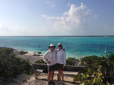
Guest day 1 (day 10 Jan 17) :  We warned her. "You're going to get wet, a lot. Did we tell you you are going to get wet?"  We started the day with a 9:00 am pick up at her hotel dock, followed by a dinghy ride across the harbor to Monument Beach for a hike. After scrambling up limestone and sand trails (we are not in Missouri!), we made it to the top then headed down to the beach on the Atlantic side. We stopped to chat with several groups of fellow, friendly cruisers then headed back to the boat for a snorkel. What followed was deemed by The Captain, "the wettest dinghy ride yet" (which I believe was previously held by Titusville, FL). She was a good sport!  "We need swim goggles."  After drying off, we decided to walk to the grocery store for dinner. Cruiser-brain forgot it was Sunday afternoon (store closed!), so we ended up at the bar next door.  After rum punches and homemade sweet potato fries, she began playing "is that a tourist or cruiser?" with the bartender until The Captain arrived to take us home. She picked up a new mantra from the Captain--"let it go."  Veggie stir-fry and rum punches in the cockpit. Early evening anchoring entertainment (2 more boats arrived). Sunset on the trampoline.


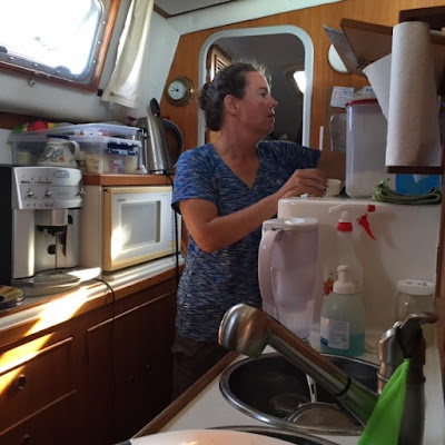
She snapped a pic of me at home on our boat--cooking in the galley!  lol


Odin's Bahamian Rum Punch


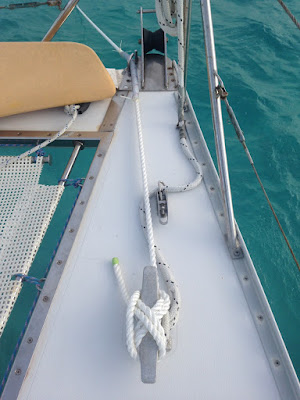
The upgraded bridle--5/8" 3-strand nylon.  Upgraded from 7500 lbs to 12,200 lbs!

Making Rum Punches like a local
Guest Day 2 (day 11 Jan 18):  It was an overcast, dreary day so we ended up in town.  We spent some time browsing the wide selection at Top II Bottom--"our WalMart" then swung theough the liquor store on the way to the market. MONTHS ago, our friends from Diva Di had shared a recipe:  "If you like Pina Coladas, you can remove the fat by just using a good coconut rum (we like Cruzan) and a regular rum in any proportion that you enjoy."  (Duane, I'm hoping there is supposed to be juice in there somewhere!)

After some careful "research" at local drinking establishments, we FINALLY purchased some Ole Nassau Coconut Rum.  The juice/mixer of choice on Odin is grapefruit juice, but we've been also been dabbling with pineapple & guava. 

Here's the trick:  A can of Bluebird juice is only 46 oz. A normal juice bottle/carafe is 60 oz. After transferring the canned juice into a carafe, The Captain said, "just pour the other juice in with it."  This is what they do it at local bars. When you order a drink, they pick up a mystery jug and pour, adding your rum of choice to the glass. Hmmmmmm.


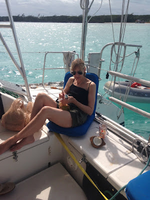
Another guest pic of The Boat Life.  Lounging in the cockpit with my iPad & a rum punch, while The Captain scatters tools about...

So arriving back at the boat, we mixed a can of grapefruit juice & a can of coconut-pineapple juice then added coconut rum.  Our guest snatched the first glass and said, "THAT'S IT!"  I neglected to do my signature "skinny" version the first round, but the second round was half club soda, 1/2 fruit juice, shot of coconut rum. "Yep, I like the fizzy."  I don't remember the recipe we used on the third round. 

Summary:  a can of Redbird juice of your choice, a small can of Jumex juice of your choice, (Ole Nassau) coconut rum.


Yep, you can see Odin from her balcony!


Ahhhhh!  The pool is shaped like a boat :-)

Guest 3 (day 12 Jan 19):  It was a cold and windy day, so I spent it hanging out at my friend's hotel.  I used to be her IT person, so we sat on the balcony, telling stories and downloading apps :-)


The Captain "cracking" our first coconut. He keeps forgetting to buy a machete.


Yum!


Our guest digging for coconut meat.

Guest 4 (day 13 Jan 20):  The sun came out so we decide to walk to the north end of Georgetown. ("Bring your backpack"). Our Guest has taken the quest for our first coconut seriously, and stops to shake all the fallen ones--tucking potential keepers in the bushes for the walk back. We find the pharmacy but continue on to the elusive "meat market" to discover a wonderful little store, staffed by expats with fresh limes, gf pasta, and yes, wonderful-looking MEAT! (We were bordering on being vegetarians. Close one!). A quick stop at the pharmacy on the way back yields more juice and some Stugeron (seasickness medication you can't buy in the States), but the Captain buys a different brand of coconut rum (Don't you read the blog?!). We collect our coconuts and retire to the boat for grilled burgers with bean salad and rum punch.  With a full belly, The Captain decides he wanted to re-anchor closer in, "so we might as well take a sail down the harbor."  A quick scramble has me at the helm and our Guest is sent up to the bow to learn more about anchoring than I know ("This is the same button as the head."  Lol. She was taking video and he didn't know!). We had a leisurely 1:20 sail down the harbor including a tour of Stocking Island anchorages and the game of "we were anchored next to them in....."  OK, that was probably boring for her, but it's like playing Memory for us.  Keeps us sharp ;-)


  Cruiser:  "Grab your backpack.  Let's run errands."  To our guest:  "Want to walk to town?"  lol

Guest departs (day 14 Jan 21):  The winds are forecast to kick up this afternoon, so The Captain ran into town to pick up a much anticipated package (Coast Guard registration renewal, sailcloth tote bags, tankini, sunblock) and to get water.  On the way out of Lake Victoria, The Captain took a wave "that was over my head" and swamped the dinghy!  He arrives back at the boat looking like a wet dog.  The anchorage is getting rough.  Our guest is leaving today, so after much deliberation we decide to do a dry run to the vet (Mama needs a valium to take the kitty in the dinghy in this!).  After confirming the location and our appointment (they kindly give me her prescription to take with me without paying), we head back to the hotel to have lunch with our guest.  She takes some flat-rate mail for our friends and we say goodbye ("that's your cab driver having a beer at the bar").  We dinghy back out and retrieve Amelia the Cat.  The ride in won't be too bad, but I strap her across my body and bring a trash bag for the return trip. Dr. Dean and his assistant turn out to be excellent. He was calm and gentle with our baby girl, exploring a scab, offering to cut her "old lady nails" and discussing the anti-inflammatory shot we requested.  They couldn't believe she was 18!  The ride home in the dinghy was uneventful (even the vet asked if we had a trash bag to cover her carrier), and after a shot of rum, Amelia and I crashed on the couch for a nap. Let it rain, let it rain!

Friday, January 22, 2016

When is high tide?

Nerd alert—The word of the day is, TIDE!  Say it with me, T-IIIII-DDD-EEEEE!

It all started with a simple question--when is high tide in Georgetown, Bahamas?  On our journey south, Mother Nature gently taught us land-locked Missourians about tides.  In Annapolis, MD the mean range was 0.97 ft with fixed docks at most of the marinas.  By the time we reached Brunswick, GA the mean range was 6.6 ft with most marinas having floating docks.  In Florida, the mean range goes back down to 2.5 ft.  In the Bahamas, it is 3 ft (mostly fixed docks).  (The largest tides in the world are 38 ft in Nova Scotia!)

Definition:
According to Chapman’s the definition of tide is “…the rise and fall, the vertical movement, of bodies of water as a result of the gravitational pulls of the moon and sun…Tides originate in the open oceans and seas, but are only noticeable and significant close to shore...Curiously, the effect of tides may be more noticeable a hundred miles up a river than it is at the river's mouth because water piles up higher in the river's narrower stretches.”  (versus current which is the horizontal flow of water.)  

The effect of the moon:  When the moon is full, it is called “Spring tides” and have a greater range.  When the moon is quarter, it is called “Neap tides” and have less range.  As we learned in Special Report: What the heck is a perigean spring tide?, "When the moon is closest to the earth, it is called a lunar perigee.  The gravitational pull of the moon is the strongest.  Three to four times a year, the lunar perigee and full moon coincide.  This is the perigean spring tide (or unofficially, the supermoon or "king tide" in New Zealand) and can affect tides up to 20 percent (usually just a few inches).  Apparently, we experienced this once in Annapolis--when it's perigean spring tide, wind blows onshore from the bay and it storms (barometric pressure drop), they get flooding downtown." (See weather below)

The effect of weather:  According to NOAA, “we cannot predict the effect that wind, rain, freshwater runoff, and other short-term meteorological events will have on the tides.”
In an example, Explorer Chart's stated, "...the tides were running at least ½-meter higher than predicted schedules—that would be 1.5 meters above chart datum—Mean Low Water Springs. This was due to the Derecho that occurred in the Exumas on January 6, 2016."  In other words, the high winds had driven more water into the Bahama Banks than usual.

Explorer Chartbook further explains tides by stating, “[it is] part science, part art…Tides are seldom exactly like the predictions.”  and further explaining that tide is affected by local features with differences at cuts.  “Generally, the farther from the ocean, the later the tide.”

The tidal flow in our part of the world is generally a 6-hour cycle between high tide and low tide and changes daily.  There are generally, two high tides and two low tides a day.

I learned the term “rage tide” from the National Park Service kayaking website, while anchored at Cape Lookout Bight just outside Beaufort, NC.  http://www.nps.gov/calo/planyourvisit/paddling.htm 
“Most paddlers will want to avoid the rage tide, the time when the current flows the hardest, as ½ of the total water volume passes through inlets during the third and fourth hours of tide flow. During this time, flatwater will turn to whitecap waves and intermediate terrain can become expert.”

This is further explained by the Rule of Twelfths:  Per Nigel Calder's Cruising Handbook, you can use the Rule of Twelfths to approximate the state of tide.  "This says that in the first hour after high or low tide, the water falls or rises by one twelfth of the total tide; in the second and fifth hours, it is two twelfths; and in the third and fourth hours, it is three twelfths."  This also means that the hour before and hour after, you are still relatively close to high/low tide.

What are tide tables:
According to Chapman’s, The National Ocean Service (NOAA) is responsible for surveying and publishing the computer-generated Tide Tables which are “…PREDICTED times and heights of high and low waters for each day of the year at a number of important points known as ‘reference stations.’”.  This information is available for free at http://tidesandcurrent.noaa.gov

More examples of tide information:
Navionics e-charts:  “Our Tide & Current data are predictions based on the government Tide & Current Stations (including many different sources, which are proprietary information)…Please note that the Tide & Current information do not take Daylight Saving Time (DST) into account, so during this time period the predictions may be off by one hour if the device settings have not been adjusted for DST.”
Garmin BlueCharts: source unknown
Explorer Charts:  pg 72 Bahamas Exumas.  Nassau tide tables, “NOTE:  this data may differ slightly from the Bahamas Dept of Meteorology tables due to different source data.”  They also give a correction range for the Bahamas of Nassau -0:13 to 0:30 (source:  Bahamas Department of Meteorology)
A Cruising Guide to:  The Southern Bahamas by Stephen Pavlidis
A Yachtsman's Guide to the Bahamas
Bahamas Department of Meteorology (bahamasweather.org.bs) daily weather forecast
The local net (usually references local knowledge)
OR:  the book Passages South, The Thornless Path to Windward by Bruce Van Sant, "Near open ocean you can assume high tide at 8 o'clock local time on the day of a full moon.  Add 52 minutes a day thereafter and do without tide tables forever!"

So when is high tide in Georgetown, Bahamas?  
It depends on who you ask.  For example, on January 16, 2016 (departing Red Shanks anchorage):
11:15 am Navionics chart plotter gave high tide at “Exuma Harbour” 
12:18 pm Pavlidis Appendix E, Nassau 12:38 - 0:20
12:37 pm Dept of Meteorology (“Exumas”)  = Nassau -0:01 
12:38 pm Yachtsman’s Guide to the Bahamas = Nassau
12:45 pm Garmin at “Steventon” (“14 miles from chart center”—North, Nassau + 7)
12:53 pm BahamasCruisersGuide.com  (Nassau 12:38 + 15)
12:58 pm local & charter captain (Nassau + 20)
1:21 pm The Net says Nassau 12:38 + 45 
(Thornless:  The next full moon is Jan 24, so high tide should be 8:00 if "near open ocean". NOAA has high tide at Nassau as 7:51)
That’s a 2-hour difference!  A local told me that high tide can be different at either end of the harbor. If you use the Thornless explanation of "near open ocean" this makes sense. The Northern entrance is the Exuma Sound (very close to the ocean) and the southern cut is very shallow water ("the banks", 11 ft) 

Why do I care?
Anchoring:  While anchoring, we need to know where we are in the cycle. Do we need to factor an additional 3 ft into our depth while calculating our 7:1 scope?  Or will it be 3 ft less under the keels than what our depth finder is reading? If there is a Supermoon or derecho (1 meter = 3 ft x 7 = 24 ft) it could be the difference between dragging anchor or not dragging (ask the catamaran next to us in Lake Worth!)

Skinny water:  Many cuts can be shallow, requiring a high tide to safely navigate through. (Others can have a significant current, requiring slack water to be navigable--another topic, but you definitely do not want to transit during the rage). The ICW also has areas that silt in, requiring high tide to avoid going aground (until it can be dredged again). Some excellent anchorages have a shallow entrance, requiring high tide to enter, but deep water once inside (RedShanks).

At a dock:  If you are at a fixed dock, and tie up at low tide, lines have to be secured with the idea that the boat will rise 3 ft at some point (usually in the middle of the night) possibly straining lines, stanchions or fenders.

Clearing bridges:  Our catamaran (47 ft mast) was in winter storage at a primarily-powerboat marina, with a bridge height just before the entrance of 53 ft. Our visit to the Albemarle Sound had us scooting under the Plymouth, NC 50 ft bridge to ride out the remnants of a Tropical Storm at the sheltered and free town dock.

The moral of the story:
Question your chartplotter.
Question the tide tables.
Confirm the location of the tide info given.
Confirm the source of the info.
Take into consideration the moon phase and weather (especially barometric & wind)
Take into consideration the range of tidal swing (2 ft or 8 ft?)
Compare the depth finder to your charts
Compare the depth finder to tide table
Keep a log
Look around--not just while anchoring but frequently throughout the day to get a feel for the area.
Ask a local fisherman or charter captain:  I've tried this and I get a lot of shoulder shrugs. "It is, when it is." Here's how they do it: visually.  Look at landmarks, pilings, limestone (water marks), sand bars/reef, slime on the side of buildings (visible?  low tide.  Not visible?  high tide)

We've also been known to stand on our stern step and attempt to "stick the bottom" with the boat hook.  We've also snorkelled down to take a look--in very shallow water, we can approximate how much water is under our keels or even stand up!

Don't get me started on low tide vs slack water.


Wednesday, January 20, 2016

Special Report: Red Shanks anchorage, Georgetown

Red Shanks Yacht Club

Georgetown Day 5 (Tues, Jan 12):  I'm up early for our reposition. The Captain doesn't think moving for all-around protection is necessary, but agrees Red Shanks looks fun (I'm still a little gun shy from the derecho!). Coffee is on. It's another beautiful Sand Dollar beach sunrise! As I step out to survey our anchorage, I can hear waves crashing on the other side of the cay. Fantastic!  The Captain makes an appearance and heads out on deck while Amelia gives him the "paw up" from the helm (quickly bored, she goes back in for a nap). As soon as the anchor is up, I realize the wheel has limited steering--it's quickly resolved--a bucket in an aft locker fell over.   Hello, differential steering. Whew!  Better than coffee!  The short reposition is 5 miles and takes an hour (I can't believe some people move everyday.).  Here is how we got into Red Shanks/Crab Cay/"the secret spot" per "The Gentleman's Guide to Passages South, The Thornless Path to Windward 10th edition.":   '...run down Elizabeth Harbor on a line 126 magnetic on JR's house on Man of War Cay.  This shall carry you by the reef off Sand Dollar Beach anchorage through a gap in the reef off Elizabeth Island anchorage.  (Caution both markers are missing from Joaquin Jan 2016)
When abeam of the house on the middle of Guana Cay turn to 222 Magnetic (Garmin has already turned you to 190) until able to distinguish a transit of the easternmost of the Redshanks and the bluff which bounds Master Harbor to the northeast. Keep these 2 features just closed, and you will pass a large coral head to starboard which stands in the center of a 100 yard gap in the reef beyond. Leave the last of the Redshanks forty yards to starboard and steer to the bluff, rounding slowly to starboard so as to leave the bluff 200 yards to the southwest. Then steer west until you see the entrance to Redshanks anchorage and pick up the darker colors of the entrance channel's deeper water."

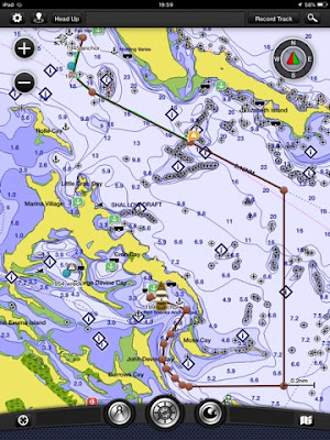
Garmin BlueChart into Red Shanks

Just kidding!  I navigated with our trusted Garmin BlueCharts on the iPad.  We're newbs driving our house!  We probably wouldn't have tried that!  Of course, we scoped it out in the dinghy the day before, so maybe! I was skeptical since hurricanes could change landmarks, but The Captain read along, and all the houses are still there.  He's disappointed when we round the corner and see 6 masts, mostly catamarans (but later 2 monohulls!) way back in there (spot 3? "The litter box"?). Mistakenly thinking they were in the hole closest to the bridge (spot 4?), we drop anchor in spot #2 ending up in deeper water than we planned (6.6 ft on the depth finder at low tide, 4 ft charted--Garmin). 

The most beautiful bridge I've seen in the Bahamas.  Crab Cay bridge to nowhere...

We listen to the end of the 8:00 am net, check in with Sasha, and I look up to see Dos Libras come around the bend.  We hop up on deck to wave and I holler over, "Hey, you can't bring that monohull in here!"  Tammy hollers back from the helm, "Watch this!"  We hop in the dinghy for a slightly longer ride into town, picking up our friends on Sasha on the way. We were careful the 1st time because of 1-2 ft along the route, but at high tide we zip straight over. The crew breaks up for errands and reconvenes at Red Boone. It turns out the veggie boat had arrived, so I scored $70 worth of spinach, mushrooms, bell peppers, green beans, tomato, broccoli, squash, oranges, and mango. We ran into pretty much everyone we know--better than happy hour at Chat n Chill!  Party on the Exuma Market dinghy dock!  

Red Shanks mangroves

The kayak is dropped in the water after the hole is repaired (a little generator mishap in the watertight bow, fixed with a screw & washer!).  Now it matches the dinghy! I paddle off to explore and discover a tiny half moon beach covered in conch shells decorated with boat names (turns out to be Red Shanks Yacht and Tennis Club). On the way back I swing by the say hello to Dos Libras then back to Odin for a snorkel out to the anchor.  I spot a sea star, cushion sea star and an upside down jellyfish (it's the first time I've seen one of these.  They're weird.  When the water is really calm, I can even see them breathing from on deck.)

Our pet sea star/starfish.  Every day, as the boat swings around, we play, "where is the star fish now?"

Quick shampoo on the stern steps.  The Captain whips up a potato, broccoli, cheddar dinner!  Dos Libras hollers over an invite to happy hour.

Stats:  total time 1:03, avg speed 4.3 kts, total 4.5 nm, motored

Another trash and water run

Georgetown Day 6 (Wed, Jan 13):  It's a overcast morning, with a few showers and a slow start.  

Some days we sit in the cockpit and watch the free entertainment.  Other days WE ARE the entertainment!  (You probably shouldn't be a cruiser if you don't have a sense of humor). 

We dinghy in to fill our water jerry cans. With the extra weight, our new outboard didn't want to "get on plane."  This a) isn't as fun b) meant a LONG, wet ride back to the boat. He had 3 jerry cans & a case of beer in the bow (where I usually sit) and I was sitting in the back with The Captain.

"Lean farther forward."  As we head through Kidd Cove anchorage, we are both laying across the jerry cans. Most people probably knew what we were doing, but I'm sure we still looked silly. "My fat butt should be up there.  You need to shuffle things around."  He stops, we both stand up and move a jerry can & the beer to the back.  

("Hey, honey. Come out here. You have to see this!"). 

I plop down in the hole, with both feet up in the air and 2 jerry cans between my legs.  NOW it's getting interesting. The worst part was, it still wouldn't plane.  If anybody got this on video, please tag Odin when you post it to YouTube. Tip your waitresses. We'll be here until the end of the month.
Sv Reach and our fellow PDQ Sam the Skull (a Scotsman!) stop by to say hello (spot 4?). Pasta primavera for dinner. 

Georgetown Day 7 (Thurs, Jan 14):  The forecast has slid back another day. The winds should be 15 today and 20 tomorrow. Chris Parker's servers had been down, so this morning we are greeted with this:  "We officially have our 1st Tropical LO of the 2016 Hurricane Season.

The LO which developed just NE of Eleuthera Wed6 evening (which we have been monitoring for possible Tropical LO formation since before it developed, and which packed Hurricane Force sustained wind when it was officially a non-Tropical LO E of Bermuda Sun10) has been declared "Sub-Tropical" Storm Alex."  I guess we can say we were there first!


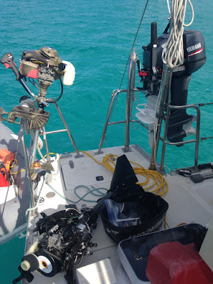
The outboard is a week old.  Might as well drill some holes!  (new fins)


A friend posts a pic of a water spout on FaceBook this morning, so we think--let's run into Red Shanks!  It's takes some exploring, but we find the "cement dock" which is really a boat ramp/rock wall with pieces of pipe or pallets to tie off to. We stop at Cheater's (bright colored building to the left) for directions, then we head to the laundromat (to the right). The power is out but I decide to wait awhile. The Captain hops back in the dinghy and runs down to Brown's Marine and returns as the sky turns dark. "Time to go!"  We scramble back to the dinghy.  Generator on, TV on, flannel jammies on.

Errands cut short.  It didn't even rain at our place.

Georgetown Day 8 (Fri Jan 15):  Alex is a hurricane.  Speechless. The earliest Atlantic hurricane in 78 years.  We head back into town (take 2) for laundry, fuel, and lunch at Cheater's Restaurant.

On the way back another dinghy flagged us down and asked if we knew where the blue hole was. We've passed over the area several times, but always forget to look. We say, "it's right around here somewhere!" I look back as we motor away--and we were sitting right over the top of it! Should we go back? "They'll figure it out..." Lol

Our afternoon snorkel takes us to an underwater cave. It's not what we thought it was (a dark hole on the bottom), but we found an amazing array of fish--"the most we've seen". The Captain saw one huge striped fish that caused him to drag out the reef fish book.

Red Shanks activity map

There is supposed to be plantation ruins and an abandoned housing development on Crab Cay.  Our Navionics chartplotter indicates a possible trail on the NW beach (spot 4) but we didn't get that far.  You can stop at Minn's Water Sports for a snorkel map and to ask about the cave.  The guidebook also mentioned ice cream in Red Shanks, but shockingly, that was never pursued either.  Guess we're going back!

A beautiful Red Shanks sunset

Tuesday, January 19, 2016

Welcome to Georgetown! Sand Dollar

Only 4 kts of wind?  We'll take it!

I apologize for this a long-winded post.  When we sit somewhere more than a week, the day # & dates become necessary because we quickly lose track of time down here!  "What's today?"  "No, what day of the week?"  At least I have our boat log to tell us when we arrived and departed and Facebook for "check-ins" I can look back on!

Where did the Captain wander off to?

Lee Stocking/Georgetown (Fri, Jan 8):  After a couple nights of excitement, we finally got a decent nights sleep, and get started a little later than planned. It's a 30 mile run to Lee Stocking Island but we want to have enough daylight to consider Georgetown. For the first time in what seems like weeks, we can see the sandy bottom through the clear water. The anchor appears to be buried up to the top of the roll bar. (Wish I had an underwater camera!)  It doesn't want to come up with windlass so The Captain has to coax it loose. The main is up, and we're off by 7:30 am. Sasha hails us on the radio to ask about our plans--NOAA is reporting possible 6-9 ft swells outside.  Instead of heading down the banks, we motor over to the cut & peek out.  It looks calm. Out we go with a report back of "gentle following 1 ft swells & 2 kts of wind."  I turn across a line of fish nets before I see them and before we know it, there are a line of boats behind us. We are motoring at 5 kts on one engine and the occasional puff of 4 kts keeps the genoa out.  When Sasha catches us about 10:00 am and advise they are turning towards Georgetown.  Some quick math reconfirms we can make it despite the late start. The second engine is cranked up & we're doing 6-7 kts--with the occasional 5 kt puff.  Kelly Nicole is texting--is it calm out there?!  It looks calm out there in the pic?!

An accidental jib in 4 kts of wind.  Who's driving this thing?  Me?  Ok, I'll put the camera down!

We pass Musha Cay--David Copperfield's place. Guess we'll snorkel the mermaid and piano next time. We cruise by Lee Stocking with a Georgetown ETA of 4:30 pm--well before sunset.  By afternoon, the water is a deep purple and as smooth as glass  (Everyone keeps telling us how weird the weather is this winter.  Who would guess the banks would be rough and the ocean would be like glass?!)  As we make the turn for the Elizabeth Harbor entrance, Kelly Nicole is texting with dinner plans. 

As soon as we enter Sand Dollar anchorage, Kelly Nicole is circling us in their dinghy.   We hop in and they whisk us off to the Fish Fry for a Bahamian pub crawl with Dos Libras, Magnolia, Agape & Manana. Welcome to Georgetown!

Stats:  total time 9:11, avg speed 5.9, total mileage 53.9, 1/2 motor sail on 1-engine/genoa, 1/2 motor on 2.

Sunrise at Sand Dollar over sv Kelly Nicole

Georgetown Day 2 (Sat, Jan 9):  It's so quiet & calm here, it feels weird. The boss is up early & we're in the dinghy by 8:00 am anticipating a long ride across the harbor to Minn's Watersports with our borrowed weed whacker (it turns out to be a little tricky to steer!). It's interesting entering an anchorage with so many familiar boats. Blogs we've followed before buying a boat, blogs of boats that crossed with us, boats we've been leap frogging down the Bahamas--and there is Sasha!  We're early, so Minn's sends us next door to the Driftwood Cafe for breakfast. Perfect!  Eggs!  A meal I didn't cook!  We confirm the mechanic is in, but he needs a couple hours, so we go for a walk through town and end up at the grocery store (run into Sasha again!). $133 later, I made a dent in resupplying (we neglected to buy dinner but the Captain is happy with his can of olives & can of beets. We ate those a long time ago! )

"First time in G'Town over here--where the hell is the dinghy dock?"  The tunnel to Lake Victoria

We were the entertainment at Minn's Watersports today.  When our mechanic, Al is ready for us, the weed whacker made him crack a smile. Then he balked at our broken transom. "You aren't going to lose this new outboard in the middle of the harbor are you?"  Is that included in the warranty?  "Please don't."  Finally, we piled into the dinghy--new outboard, the two of us, $133 of groceries, the weed whacker, the old aux fuel tank and new aux fuel tank.  "I should have brought my snorkel gear.  I could have swam back!  Do you want to come with us? We'll take you to lunch!  No?"  He was laughing and shaking his head as we motored away.

It looks like a dinghy repair shop over here!

The new outboard is hoisted up to the rail & the transom repair begins. A piece of corian from the free table at Brunswick is put to use. (Al approved!). Our lock also doesn't fit so The Captain does a MacGyver. He takes it out to play in the anchorage. "Did you see me get on plane?"  No, do it again!  Go buzz Kelly Nicole! Magnolia anchors behind us. I spend the afternoon emailing back and forth with a friend that wants to visit when I'm informed the dinghy isn't holding air because of a tear at the hull. Sympathy pains with Sasha?  I pull out our insurance policy and send an email to to report the damage.  As the sun sets, it's so quiet, The Captain hates to start the generator.  The stars are brilliant through our berth hatch!

Georgetown Day 3 (Sun, Jan 10):  Another great nights sleep. We listen to the morning net while I do bucket laundry which includes "newcomer info."  When I jump on to say thank you, R&R Kedger hails us (fellow Black Point derecho survivor) and we chat for a while.

The dinghy get's on plane with the two of us today!  It's terrifying and exciting all at the same time. If you saw a dinghy zooming across Elizabeth Harbour, giggling and yelling "Yee haw!", that was us!  Of course, we were bailing before we were halfway across the harbor--we have a BAD leak!  It was still fun!

A slow day at the Exuma Market dinghy dock

We stop at Sasha to drop off the weed whacker.  They give us a tour of their beautiful Island Packet --we had airline tickets to seen one but never made it.  (You know you are cruising the Bahamas when:  friends offer a tour of their beautiful boat, and at some point you say, "Look, they have potatoes!")  Another grocery store run results in overloaded backpacks with a stop at Red Boone for brunch (a popular cruiser spot next to the grocery store with free FAST wifi). 

The Captain does some more fiberglassing on the dinghy, trying to stop the air leak. We both go for a quick swim, but our anchorage is too deep with low vis for seeing anything. However, the swim reveals the chunk missing out of dinghy fiberglass hull.  Two of the boats that survived the derecho in Black Point arrive and anchor on either side of us--Alta Mae & Eclipse.

Red Shanks reconnaissance--any excuse to run around with the new outboard--clocked 17 kts!

Before leaving Black Point, I was already looking for our "all-around protection" in Georgetown. A friend had told us about "Crab Cay" and Magnolia confirmed they had been back in Red Shanks--"the secret spot. It's in Thornless."  We decide to dinghy over and check it out. It would be a great place for a blow. We put my iPad in a dry bag and tie it to the painter, then I sit on the floor in the bow and give hand signals around the reefs and down to the entrance. There are great little swimming holes and lots of reefs to snorkel. The water is pretty, calm and shallow along the reefs and cay. We only see two boats, a little sailboat on a mooring and a large powerboat (appear unoccupied). We investigate a sunken sailboat then take the shallow creek back around to town. It turned out to be 7.8 mile loop! 

Georgetown Day 4 (Mon, Jan 11, Bahamian holiday):  Five of the six boats from the derecho/gale in Black Point have made it to Georgetown. We had a beach meet-up at Sand Dollar Beach with sv Sasha, sv R&R Kedger, sv Alta Mae & sv Eclipse today followed by a hike and lunch. Two of the boats confirmed they clocked 78.9 kts and were well aware our boats were unattended!  Whew!  Alta Mae was anchored in front of us and his bridle failed--twice!  That group can tell some stories! I forgot to get a group pic :-(

Kelly Nicole comes over to consume some beverages.


Friday, January 15, 2016

Jan 6, 2015 The Black Point, Exumas Gale/Derecho?!/hurricane force winds

Some of the damage to the Government dock

(This is an ongoing situation. More pics & info when available.  UPDATE:  This low will become Hurricane Alex!)

A friend requested that the blog include "the good, the bad and the ugly."  Here is the ugly:

Jan 6th, 2016:  The weather forecasts are still contradictory. There is another possible clocking of winds through west, but after naps, we decide to move to Black Point since it is no more or less protected than Big Major. We motor sail on the genoa & one engine at reduced throttle the 10 miles on a beam reach. The waves are hitting us on our beam which is usually preferable but the banks aren't happy and it's a short but rolly ride. We only see 6 masts as we enter the channel and drop in line between sv Sasha and a Lagoon.  Still punch drunk from an anchor watch of 25-30 gust 36 the night before, The Captain increases his normal 7:1 scope to 10:1.

We decide to head into town for errands and a decent meal. We tie up at the government dock alongside 3 other dinghies. (It's a tall dock. Standing up, I can't reach the dock above my head, so I wrap the painter around the ladder and climb up. The Captain resecures it to a piling). We head towards a restaurant called Scorpios, noting the trash dumpster, water spigot, bakery and grocery store on our way (fresh eggs!). There is a table of cruisers at Scorpios as we arrive. They invite us over, but after a night of anchor watch, we don't have the energy. We order drinks and food. Pretty soon, their party breaks up and we chat with them as they leave. One couple stays behind (spoiler alert. sv Sasha) and we chat across the aisle. A quick rainshower comes through, so the bartender asks us to relocate inside. 

Not much later, a local comes in and asks if it's "our inflatables at the dock because they are in danger."  The men rush out and the girls stay behind to wait for our food. Someone comes in and says a big boat is on the rocks, so I throw my purse on Sasha's table and run out the door (I later learn a local lost his "big powerboat.") When I reach the dock, I see waves coming over the dock and no sign of the boys.  I can see our blue stern light still out in the anchorage.   It's getting dark, so I run back to Scorpios just as the power goes out.  More locals stagger in and our food finally arrives. An eternity later, the boys return. They are soaked.

The Captain's new glasses blew right off his face. They moved one dinghy to the other side of the dock and our dinghy to the beach. (He'll explain later that as the dinghies came up on the 4-6 ft waves, they were "flying" in the air.  While trying to move our dinghy down the dock, the outboard smashed up into the dock and the painter flew out of The Captain's hand. Luckily it went straight up on the beach, where locals helped secure it to a chunk of cement with chain attached.). We discuss the real possibility we may not be able to get back out to the boats tonight if it doesn't let up. We chit chat about other things--anything except our homes that are in imminent peril and there is no way for us to get to them. It turns out R is a pilot so that keeps us occupied for awhile. We settle up and the bartender says he will help us find somewhere to stay in town if need be. We take turns poking our heads out the door until, finally, the lights come on. The winds seem to have let up, so we walk down to the dock to check things out--"just for fun."

(The rocky beach where Sasha's dink landed)

The dock is missing a lot of boards and there are pallets from today's mail boat strewn down the dock.    Our dinghy is still on the beach but Sasha's brand new AB is not where he left it.  The locals coax us off the damaged dock.  Other locals find it washed up on the rocky beach. The aluminum hull is dented with a rip where the inflatable meets the hull. A large group helps drag it up and around to the other "marina" beach. Our outboard is in multiple pieces. Sasha's outboard is a little damaged (bent prop) but still runs, so they move it onto our dinghy. A local helps drag our outboard inside the government building--a little tricky with a broken lower cowl.  The water is almost calm now. All four of us pile into our dinghy and they drop us at our boat and continue onto their boat. 


(Dinghy/outboard--we shared with Sasha)

(Pic Anchor app) The cat is asleep but the boat is no worse for wear. I had closed up anticipating rain and everything was still stowed from our sail except for two drinks on the salon table. We head to bed after confirming the chartplotter & anchor alarm agree we are still where we were. (Pic) About 2:00 am the winds shift to the NW at 20 kts, making our home a bouncy castle again (Black Point not protected from the west). We can't sleep and The Captain decides to sleep in the salon, while I stay up until sunrise reading other's accounts on Facebook (see below). 


(Pic) Our chartplotter trick--one of the interesting things about reflecting on this storm was, how do you know if you're dragging?  We've tried several anchor alarms with mixed results. We currently use the "Anchor" app, but still get the occasional false alarm. Our secondary anchor alarm is:  When we drop anchor, I create a new waypoint named "anchor". When the anchor bites (I can feel it in my bare feet or I see a bow swing away from the wind), I create a second waypoint named "bite". Finally, when the bridle is on, I make a last point named "bridle."  This gives a line that should represent our swing radius. If the winds shift, we add another waypoint (in a 360 degree windshift, you should have an equidistant circle around the anchor.  If we get a gust that stretches the chain, we create a waypoint to show us the new radius). If the anchor alarm goes off, a quick glance shows if we are inside or outside our last mark or if we've swung to a new position (reason to be watchful).  Of course, when you are not on the boat, this technique falls apart!

We're still relatively new cruisers, but The Captain is a certified aircraft mechanic & IA. Redundancy and safety wire/zip ties are all over Odin. I quizzed him on our setup after hearing about some of the failures (I'm embarassed to admit, besides the ocassional conversation while buying parts, I was blissfully uneducated on our current set up). For what it's worth, here is our anchor set up--straight from the Captain:  "Primary anchor 44 lb Mantus with 120 feet 5/16 G4 chain + 200 feet 5/8 rope.  Primary Bridle: Mantus chain hook with 2 25 foot 1/2" three strand nylon lines connected to chain hook with 3/8 shackle. 1" water hose for chafe protection at chocks.  Secondary bridle: 5/16 chain hook with 5/8 double braid eye splice looped over port cleat.  All shackles safetied with nylon zip ties."  Our old primary anchor was going to be connected to the rope rode in the starboard bow locker, but we left Brunswick before this was completed. "Perhaps I should get that done."

We used to worry about dragging, but our new #Mantus anchor has been solid, so now mostly we worry about others dragging. However, we heard several stories of other cruisers having bridles FAIL, chain paying out uncommanded and LOSING anchors!  Nightmare!  That will keep me up at night. 

Another bad contributing factor here was, it was after dark. Everything is more difficult in the cockpit and on deck in the dark.  It will be a long while before I am comfortable going into town after dark. God bless the locals who were on the beach looking after their own property and stopped to help us. "That's what we do."

The day after (7th):  After sunrise, I finally fall asleep for a few hours. We finally get coffee and breakfast by 9:00 am and hail Sasha on the radio. We're on the beach by 11:00 am with a bag of tools and discover Sasha's dink has 3 tears, only one major. They air it up, bang out the hull & work on the leak. Next is our outboard. The Captain was confident he could get it running but in daylight, it's a broken carb, broken intake, broken lower cowl frame, broken lower cowl mounting lug is broken off at crankcase, bent prop, and a missing gas cap.  He figures it needs $800 worth of parts.  I walk down to retrieve our aux fuel tank from a local business owner who took it for safe keeping. We make a quick grocery store stop and upon return, we have two dinghies again (kind of). Sasha tows us out to our boat then returns with their spare trolling motor to loan us. Guess we'll be seeing them in Georgetown!

Excerpts from the Chris Parker summary on July 7th:
"StanielCay reported (confirmed independently from multiple sources) W-NW@45-50 with gusts at least into the 60s from about 6pm-7:30pm EST.

CambridgeCay (about 20mi N of StanielCay) recorded a gust which registered 106.2k on an anemometer. Even if not precisely correct, there were almost certainly Hurricane Force wind gusts.

Most reports were a bit less...mostly W-NW winds in 30-40k range, gusting 50k+ persisting about an hour+/- generally between the hours of 5pm-8pm in RoyalIsland & RockSound Eluthera, various locations near GreatExuma/LittleExuma."

"In 13 years, I don't think I've seen an event like this in the Bahamas. Although there was some fairly strong convection (Lifted Index -4 to -6, and CAPE 1000 to just under 2000), there were no very tall (cold) cloud tops. Infared Satellite cloud top temps were only about -20C TO -30C, suggesting cloud tops probably in the range of 20,000' to 25,000' or maybe a bit higher. In order to generate observed winds, I would expect cloud top temps below -50C, and cloud tops well above 40,000'."

"If we pick a point along TROF W of Andros (24N/80W) at 10am...and follow TROF E thru Bahamas (to 24N/73W) at 10pm, it covered about 400 miles in 12 hours, moving about 35k. As TROF began rotating around the LO which was developing just NE of Eluthera, the S portion of TROF/convergence moved more rapidly than the N part (closer to the developing LO)...and TROF/convergence gradually became more NNE-to-SSW-oriented. But throughout the day our TROF/convergence spanned about 300-400 miles from NE-to-SW (or NNE-to-SSW)."

What is a Derecho?
http://www.spc.noaa.gov/misc/AbtDerechos/derechofacts.htm

"Our event seems to meet all these criteria...we saw an event:
--over 300mi from end-to-end, and persisted along a path over 400 miles
--widespread wind gusts 50k+ along most of the line, with well-separated areas of 65k+
--straight-line winds, with reports of mostly uniform W-NW wind direction (perpendicular to the squall line)
--pool of cold air aloft located behind the squall line
--relatively-dry (cloud-free) conditions ahead of the squall line (at least in some areas)
--some sort of a shelf cloud was clearly visible in many of the photos I saw taken in Georgetown just before the event
--this occurred along the SE side of sub-Tropical JetStream, in an environment of strong wind shear

I can't be sure what we saw was a Derecho, but it was certainly (thankfully) a rare event."

Day 3 (8th):  I'm feeling a little emotional this morning. Perhaps the adrenaline or shock of the last couple days has worn off or maybe I finally got a good night's sleep. I was awoken by a pan-pan at 4:30 am this morning. One of the boats set adrift by the derecho is on fire at a wooden dock in Staniel. A pumper truck was supposed to be on the way, but everyone was at the boat on the rocks on the other side (Big Major). 

(Day 4:  next blog will cover Black Point to Georgetown)


(Transom--a piece of free corian)

Day 5 (9th):  Pick up new ouboard. Dinghy taking on significant amount of water. Had to start bailing halfway across Elizabeth Harbor.  Temporary transom repair. 


Hull crack--that blue is the water underneath!)

Day 6 (10th):  The hits keep coming. We discover the source of the leak while snorkeling--a 6" rip in the fiberglass hull.  Temporary fiberglass repair. 

Day 7 (11th):  Five of the six boats from Black Point have arrived in Georgetown. We gathered on the beach, went for a hike then sat down for lunch. This group can tell some stories!  Two boats clocked 78.9! (Pic)

Day 8 (12th):  Another run into town with Sasha for parts. They are hoping to resplash soon.  Insurance paperwork initiated. 

We aren't always the social butterflies at an anchorage. But we are usually very familiar with every boat in our immediate vicinity for various reasons. I like to people watch.  We peek through our binoculars to check their boat name & hailing port. Then we play name-that-boat. "That's a Switch 51.  Very rare.  Cool boat."   We rarely participate, but we listen to the radio chatter. We follow their comings & goings because we try to run the generator when are neighbors are in town (or just so we know where the dinghy dock is).  Ocassionally we'll check to see if they have a blog or facebook page. Some boats we've seen at several anchorages get nicknames like "red dinghy" or "Hatchet Bay schooner."  (When our dinghy is in the davits, you can't see our boat name. Apparently, were were "little cat" while anchored behind the grotto.  Yeah, not the Lagoon!). We check where all the boats are at sunset (who does and who doesn't have on their anchor light). At sunrise, I pop out to check ours and all of our neighbors positions. "Hey, Island Packet left!"  Our anchorage is our village. It changes day to day. We may not know their names. But one day we'll run into them at a bar and say, "yeah, you were anchored next to us in...."  So hearing the boat names of those who drug, ended up on the rocks and caught on fire was devastating. We never met, but they are still our people. Cruising is a small community.

Neko (Staniel):  http://svneko.com/2016/01/10/gale/
Magnolia (Georgetown):  http://a2baker.com/magnoliablog/?p=5679

Saturday, January 9, 2016

Staniel Cay & James Bond's Thunderball grotto

You never what what you are going to see out here.  If we had to have a monohull, this looks nice...

We were informed by some fellow boater's in Warderick that today is New Years eve, and there is a big party in Staniel. Huh?  FaceBook usually keeps me abreast of holidays such as Thanksgiving and Christmas, but this one snuck up on me.  We need water and groceries, so we release the mooring ball by 7:45 am with the 2.5 current coming in the cut. The forecast 15 kt winds are more like 20 (with 2 ft waves on the nose), so after a few tacks, we give up, drop sails and motor along shore. Staniel Cay announces on the radio that there is a regatta today! Dang. Our first choice anchorage is across from the marina, just east of Thunderball's grotto. (Snorkel, baby!) 

As we near Big Major, we can see at least 20 megayachts anchored around the corner from Staniel. Uh, oh. That was plan C.  As we near the entrance channel, two more race boats are headed out. We think we see a few openings in our second choice anchorage.  "I smell pizza."  Focus, people.  As I head back around the grotto, The Captain says, "What about over there?"  Yep, that's our first choice anchorage. It starts to look like there is not enough room with the other cat (Switch 51, sv Neko) until I swing around their stern then a huge patch of sand opens up. Score. Internet and Naps!  Too tired to drop the dinghy in the water.  (I was awoken by the fireworks on the beach and popped outside to watch.  The Captain slept right through!)

Chartplotter on the way into Staniel.  Yikes!

Stats:  Total time 5:15, avg speed 4.7, total mileage 24.8 nm.  One hour sail.  Motored 4:15.

Year end total: 1765.1 nm.  Averaged 75 miles/week (excluding 3 months at Brunswick for hurricane season).  Averaged 100/week since departing for the Bahamas.

Day 2:  We are headed to the marina by 8:30 am for 3 jerry cans of water & 2 of fuel. We're lured to the yacht club restaurant and have a huge breakfast that ends up being brunch! At first we were told the stores were probably closed, but after several requests, the marina calls around to advise everyone to open. We walk into town to the Blue store (groceries), then by the laundry/liquor store--brilliant!  I scramble back to the boat for sheets & towels while DH does another water run (he gets it up to 3/4--just enough to slosh). Kalik is $64 for 24 bottles, cheaper than going to a bar, at least. I'm back in time for an afternoon swim. We're told by the locals it's unseasonably warm and fortunately, we're anchored in our own little swimming pool--a triangle of sand that is 5 ft at low tide. We can see our anchor chain & bridle laying on the bottom. Too lazy snorkel, I grab a noodle and a deck line and tie myself to the boat and float around while DH snorkels the anchor and scrapes the bottom.

Nirvana.  This saves a stop!
Even the Staniel dinghy dock is scenic!

Day 3:  I do some bucket laundry and hang it out before heading back into town. We walk to BTC to top up our data plan but they're closed.  We head to the "grocery by the creek" where we score a dinghy anchor ($44 reasonable), a new Bahamian ensign flag ($24 less than West Marine), oranges, some veggies (potatoes, onion, bell peppers--hash scramble!) and diet coke (not expired). Big Dogs & Purple Restaurant are closed so we retire to the boat for lunch and an afternoon snorkel around the boat. I graduate from the Captain's school of snorkeling--"here's your scraper!"  Win, win. An afternoon swim to cool off, exercise and Odin gets his belly rubbed.

Dinghy beach

It's Sat, the weekend after New Years. In my previous life, day after Christmas through the weekend after New Year's was always busy.  I spent the last several years in Marsh Harbour. Apparently the customer service industry in the islands refers to it as "hell week".  The planes flying into Staniel are constant. A Prout and a beautiful Island Packet monohull (spoiler alert, Sasha) tuck in behind the grotto with us in anticipation of the west winds. We're all pointing in different directions because of the current. Calm winds mean bugs :-(

Odin behind the grotto

Our swimming pool

Day 4:  Low tide has worked his way to 8:00 am, so we head for the grotto with our snorkels and new dinghy anchor (moorings are all gone?). A little confused about the entrance, we were hoping for someone to follow, but we finally find our way in--about a foot clearance, just enough for my snorkel without holding my breath. As we exit the other side, the morning sun in shining down on the reef and the visibility is excellent. We can see Odin, but have to swim back around for the dinghy.  All the yacht tenders have shown up. At the boat, I jump in to wash my hair and discover I can touch bottom!  That means about 2 ft under our keels. Grab your scraper!  With extra money in our restaurant budget from Land & Sea, we hit the Yacht Club again for lunch. 

Staniel Cay airport

Staniel Cay FBO

Day 5:  The wind is supposed to swing around through west today. There are few anchorages that have protection from west winds, so more boats try to join us on our little patch of sand--we're up to 6! We forgo one more pass at the grotto, but by afternoon it's declared a nice day. Naps, reading and an afternoon snorkel. The Captain bails just as another ray cruises by the edge of my view. All of a sudden, the dark line of clouds associated with the front roll over the horizon. Heads pop out of every boat simultaneously. All hands on deck zipping, securing, stowing on every boat. It's over as quick as it starts. At least the boat is clean! Bean salad for dinner. 

Day 6:  We're officially bored and ready to move but the forecast calls for 30 gusting to 40!  The movie marathon starts at 9:00 am. All of our neighbors pull up anchor and by 1:00 pm, the incoming tide combined with the 20 kt NE wind has us sea sick at anchor. Despite the fact these were the conditions when we first anchored (and our anchor has to be BURIED), we decide to bail for Big Major anchorage around the corner.  It is considerably smoother here and we can see at least 4 pigs on Pig Beach, that run out to each dinghy that approaches. It begins to rain sideways just before sunset and we hunker down for the evening. We decide on anchor watch with a steady 25-30 kts gust 36. Is that megayacht getting bigger?

Stats:  Total time 0:20, avg speed 5.1 kts, total mileage 1.8 nm.  Motored

Being in these conditions on our boat is referred to as the bouncy castle--not uncomfortable but annoying after awhile. Throw in some rain (similar to a tin roof), sloshing water (next to our berth) and fuel tanks, bridge slap (waves hitting bottom of bridge between hulls), howling winds and humming rigging (wind blowing contrary to our standing rigging can create a vibration) and you've got yourself a party!  Seriously, who can sleep in that?  For variety, our depth finder is drunk--giving random alarms despite 10 ft of water, to make you run into the cockpit.

There's more. Stay tuned!