Wednesday, December 30, 2015

Motor-sailing and the Thorny Path

What is motor-sailing?  Using the engine and sails together. It can be one or both sails up, with one or both engines running (full or partial power). A majority of the time, our configuration is full genoa and one engine at 50% power. (This changes based on current, pounding into the waves slowing our forward speed, and desired ETA). Leaving the main up helps with stability but it's more difficult to raise and lower--requiring someone to go out on deck. The genoa can be unfurled and furled quickly from the cockpit and gives us the most speed.  Our boat is built to be a SAILBOAT and the stability and directional control suffers when we are forced to motor with the sails down (too windy or headed straight into the wind).

Why motor-sail?  We first heard about motor sailing when we went to our live-aboard cruising course in St Pete. Our instructor told us we would be doing it a lot?!  At the time, we used it to move from one anchorage to the next to keep to the classes' timetable, despite the wind speed & direction. We did more pure sailing in our early days on our boat, but as the days have gotten shorter, the daylight dictates whether we can clear a cut or anchor at our next destination before dark.  On Winter Solstice, the shortest day of the year, there was 11 hours of daylight (vs 14+ mid-summer). The difference between 5 kts & 6 kts on a 55 mile trip (ie. crossing Northern Channel to Eleuthera) is 11 hrs vs 9 hrs!  The downside, of course, is the noise, vibration, drag (most PDQ owners agree that we gain 0.5 kt with engines retracted) and expense. Even with all the motor-sailing, our average fuel burn from Lake Worth to Marsh Harbour was 3/4 gal/hr. 

Our current route from Florida down the Caribbean chain is called "the thorny path", which means sailing to windward (into the prevailing southeast trade winds), our worst point of sail (we can only point to 60 degrees off the wind where most monohulls can do 45). It is also our slowest and most uncomfortable point of sail--and requires a lot of attention from the helmsman.  Jimmy Cornell, author of World Cruising Routes describes our intended path southbound as the "...inter-island route (AN113E) that threads its way through the Bahamas, Turks and Caicos and the northern coast of the Dominican Republic to reach the Caribbean Sea through the Mona Passage."  "The Gentleman's Guide to Passages South" by Bruce Van Sant (http://thornlesspath.com/) breaks it down even further into short stages and is summarized by Cornell:  "..take one's time and watch the weather carefully.  Even in winter, when strong easterlies are the norm, the frequent fronts provide a respite of calms and light winds.  The recommended tactic is to sail ahead of such fronts and then run for shelter as the front approaches."  We have a lot of motor-sailing and waiting-for-weather-windows in our future. Now we are waiting for the Christmas Winds to blow through (strong winter trades). Chris Parker further defines benign crossing weather as "less than 15 kts and less than 4 ft waves"

Many fellow cruisers advised us to "take our time and enjoy" the Bahamas.  However, much of our schedule is dictated by weather--as each front comes, we either have to stay put for 3-5 days (if it's a protected) or make a run towards our next intended stop. Great Guana was my favorite spot so far--I would have loved to stay and snorkel, explore and visit with sv Willful, but it wasn't protected from the north and a blow was coming. Although the decision, the jump to Eleuthera was ours, Chris Parker predicted it would be "after Christmas" before cruisers could move farther south--10 days!  Some of the best advice was from our new friends Harriett & Skip. They sat us down in Vero, and went through the chart books with us page by page. Our takeaway was--be ready to move when and where Mother Nature says!

Exuma musical anchorages (Christmas)

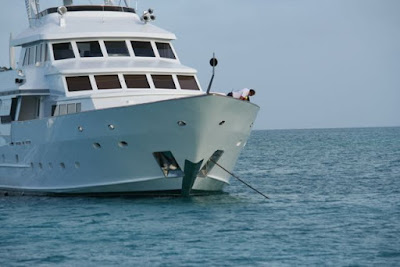
It's hard to get scale for the size of the megayachts, but check out the crew member on the bow...

One of the surprises in the Exumas is the megayachts. There's at least one in every anchorage and they keep getting bigger!  We are also learning to play Exuma-musical chairs--"Everyone raise anchor at 9:00 and race to the next cay." 


Norman Cay:  The Captain, who isn't a morning person (no chit chat before his second cup of coffee or longer), comes out of our berth in Highborne with, "Where to next?!"  After double-checking that this is our last fuel & water stop before Warderick Wells (Land and Sea Park has no services. Compass is the next water stop), the dinghy goes in the water. Seriously, we can barely get the outboard on because of the swells. I hand him the handheld radio and tell him the proper radio protocol is, (overheard from the megayachts) "Odin, Odin, shore team." Lol.  My Captain, Oh Captain, My Hero dinghies the mile to the marina for 3 jerry cans of water, and 2 of fuel (he returns with a bottle of vodka as a present for his First Mate--smart man). I watch him through the binoculars until he is out of sight, then crank up VHF channel 16 and begin our departure prep. When I go to flip some breakers, I see the batteries are 12.09--below the bosses' 12.15 minimum. Yes, the fridge is running, but flipping it off brings us up to 12.14. Dang it. We'll be motoring soon, but that could be an hour?  The Honda is still in the cockpit, so with trepidation, I crank it up.    (No explosions. That's good!)
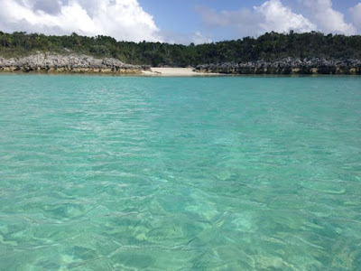
Shallow boat route

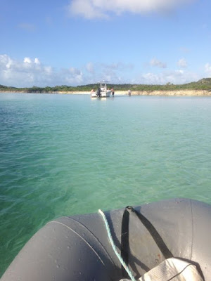
When he returns, the anchor is quickly up. He plops down for a break while the First Mate motors out to the route. It's rough away from shore, so after clearing the reef, I duck back in to pick up the shallow draft route. I'm concentrating on the the chartplotter and autopilot while the Captain identifies the coral heads along the path. Pretty soon, we pop out out an anchorage with a megayacht and 2 sailboats. We find a spot close to the beach just in front of the megayacht and drop anchor in a light swell. The water is 7 ft and clear. We could probably swim to the beach. We also have a view of the airport. A surprising number of airplanes are arriving and departing the north-south runway in 20 kts of SE wind.

Norman's used to be the hideout of drug lord, Carlos Lehder (and yes, the setting of the movie, Blow). The island is now privately owned with a small resort. 

Stats:  Total time 2:04, avg speed 4.7 kts, total mileage 9.8 nm, motorsailed.

Merry Christmas, family & friends.  Wish you were here!

Christmas Eve:  Our second day in Norman is regrouping. We have a great nights sleep (no howling winds!). Over a leisurely breakfast, The Captain decides we should dinghy to the DC-3 wreck off the end of the runway (drug smuggling plane?), then swing back by McDuffs Restaurant, however the waves are pretty big for our dinghy and we're soaked before we reach the point. We turn around, electing instead to take a walk on the beach (Is this our first walk on the beach?  That can't be right!). It's an interesting beach, with natural limestone slabs scattered in the sand. Weird! (Yes, we have a rigid bottom dinghy). We confirm the restaurant is still open (it was closed in 2013 after a hurricane and wasn't always open to cruisers--part of the private resort), then walk out to check out the runway. 

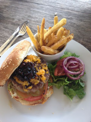
Christmas Eve dinner @ McGruffs.   Norman Cay, Bahamas

After changing into dry clothes, we warmly welcomed at McDuff's for our Christmas eve meal of Bahama Mama's, Kalik, and 8 oz angus cheeseburgers with onion confit ($25 each but they were fabulous!  The crews from a few other boats stop by but balk at the prices--seriously private resort. The next nearest restaurant is...I don't know!).

Norman Cay beach

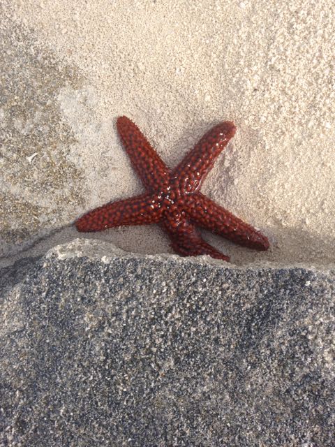
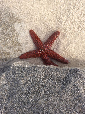
After lunch it's SNORKEL TIME!  My third attempt, it takes me awhile to get set up, then we're off on my longest snorkel. We check the anchor, then follow the limestone down the beach. Seeing brilliantly colored fish (I've only seen in aquariums!), shells--still in the water, several sea stars (starfish) and I believe, one very shy tube anemone. Amazing!  When you get tired, you just float for awhile (or let hubby take your hand and pull you along)!  Even The Captain is fun to watch--normally one to keep moving, he floats above things for a long time, observing--making me smile. We work our way out the the nearest small coral head then back to the boat--being followed by a decent-sized Great Barracuda (not recommended for eating in the Caribbean because of ciguatera poisoning).

Sunset, Norman

By sunset, our little anchorage has swollen from 5 boats to 13. Our neighbors on the 52 ft cat, Aristo are circling the anchorage with their center console dinghy, pulling the kids on a SUP. "That looks fun."  I want a SUP.  "I want a dinghy that can pull skiers!"  Christmas Vacation The Movie is popped in the DVD player.  Before bed, I pop out one more time and discover another catamaran has nudged up between us. Too close my friend. Too close. 

Christmas tree, Norman

Short sail on Christmas Day/Shroud Cay:  As soon as we're up, we start getting ready to move. A loud roar comes from the boat next to us. "Did they bring their Harley?"  Wow, it's early for a generator that loud. By 9, the anchor is up and I turn the helm over to My Cappy. It's 6 miles around the corner to Shroud Cay. Our path is basically an arc, which means I'm constantly grinding a winch to keep the sail trim up to his standards.  Halfway over, we cross into the Land & Sea boundary. We see 4 masts and a megayacht (seriously, I think it's a cruise ship) at the mooring field, so we elect for the more shallow, northern anchorage. At the last minute, we change our mind about where to anchor--"It's still rough out here (frowny face)," so I snuggle farther in to 6 ft of water, just south of the entrance to Driftwood Camp. We have tiny beach off our bow and crescent beach off our port side. "Nobody else will come back here!"  

Anchored in Shroud Cay

Stats:  Total time 1:23, avg speed 4.5, total mileage 6.3 nm (1/4 motor, 3/4 motor sail genoa/1 eng)

Jimmy Buffett, The Christmas album is on!  Mele Kalikimaka, friends.


My Captain is ready to explore, so we dinghy over to the tiny beach off our bow. The water is deep all the way in. When we step out, I sink several inches into the softest white sand I've ever experienced. There are no footprints. It's like we are the only ones who have ever been here. A tiny barracuda is fishing the area. The view back towards our boat is stunning! (I forgot the camera and the light won't be the same later.) Merry Christmas to us!  We dinghy down to check out the entrance of the creek entrance we'll do later. 

The 25ft powerboat aground (again) on the dinghy creek

After naps, we are back to a rising tide for the dinghy down the shallow Sanctuary Creek (Explorer Chartbook Exumas, "dinghy traffic at idle speed") through the mangroves to Driftwood camp ("Built during the 1960's by a sailor living on his boat just inside the creek, the camp was used by drug agents in the 1980's to spy on aircraft flying from Norman's Cay."):  You want to leave on the rising tide, because there are some shallow spots on the way in. We leave a little early, so we swing by our little beach and then head over. For some reason, I end up out of the dinghy in the shallow water and pulling. It's a great lesson in reading water depths, as I plop my butt on the bow for ballast and give hand signals. Near the end, I see a woman sitting on a sand bar, holding a baby. Photo shoot?  We round the corner and see the 25 ft powerboat hard aground. The Captain stops to help pull, but seriously, they'll float in about an hour. ("They had to come in for the ocean side."). They speak very little English, but we heard, "Armando, Armando!  Jet ski!  Jet ski!"  OK, you're on your own. We hop up to the beautiful beach and tie up then look for the trail up to Driftwood Camp. We can see our boat, Norman Cay and the powerboat heading back where we came from!  We head back and find our foreign friends aground again. "Get a picture of this!"  No, we can't pull you with our 4 hp dinghy!

Warderick Wells/Hawksbill:  We decide to skip Hawksbill and head for Warderick Wells. The anchor is up by 8:30 am and we pass by the shallow boat route for a favoring wind "outside". Mistake. We have the genoa out and are, basically sailing @ 6 kts (one engine at idle). The winds build to 26 kts and we are taking 3-4 ft waves over the bow, when I hand the helm over to the Captain (Thornless Passage, "On the passage down the banks behind the Exumas you'll close reach on 20 kts of wind without a ripple on the water."  NOT!)  I open the companionway door to check on the cat, and the water out of her bowl is hitting the ceiling and she is sitting on the salon staring at me--soaked!  "I know our house moves, but I didn't know there is water involved!"  One hatch, closest to the cockpit is cracked 1/4", so I scramble to close it. Then hold the cat for a few minutes. The couch is soaked. A quick walkaround reveals the hatch next to our berth is also letting in water (I left on the external hatch covers. The seal will take a leech line without leaking, but NO CLOTH.). As the 9:00 Warderick broadcast comes on, The Captain says, "Do you want to call or shall I?"  Seriously?  After discussing 3 more hours of this, the amount of wet things below and the perfectly good anchorage over there, we make the turn. After dropping anchor as close to the beach as we can get (the two monohulls on the moorings look rolly), all the wet things go flying out the companionway into the cockpit.  The Captain starts hanging things up without asking questions. The cat is SUPER pissed. She's dry now and gets more some hugs. She's calmed down but her nap spot is GONE (hanging outside to dry)!  Dad gives her an old t-shirt. "Who are you trying to kid?"  Her old blanket?  "NO!"  She gives up and goes out in the cockpit for a nap. 

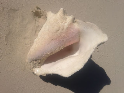
My souvenir conch pic, from Land & Sea

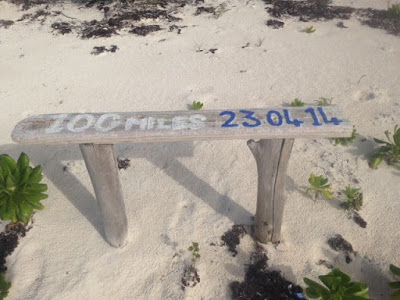
After lunch and naps, we drop in the dinghy in the water. As I look down, I see a decent sized ray swim under our boat. Why, hello there!  Where's my snorkel?!  We head off to explore the ruins & find a beach covered in conch shells?  Someone has punched the hole to get at the meat, but we're in Land & Sea Park?  How old are they?  There are hundreds!  There isn't much to the ruins. (How much were we expecting from 1735?!). We get a beautiful view of the bay. On the way back, we stop at our beach for another walk.  Apparently, it was a plantation and there is a field full of palm trees?  And this bench?  More questions than answers.
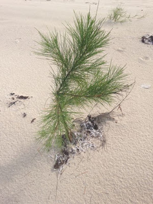
Hawksbill.  No idea.

We're back at the boat just as the "shore team" from the mega-yacht (aka aircraft carrier!) arrives and this afternoon's entertainment is--3 kite surfers. That looks hard. "How do you even learn that?"  They tack back and forth near our boat but the wind gradually carries them farther and farther out. The less experienced surfer ends up WAY out there, and the tender goes to retrieve him. Red beans and rice in the pressure cooker. 


Stats:  Total time 1:30, avg speed 4.6 kts, total mileage 6.8 nm, motor-sailed genoa/1-engine.

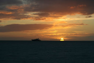
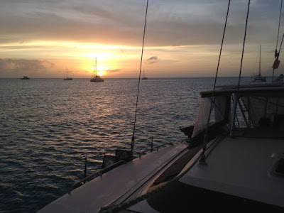
Sunset over the megayacht.  Hawksbill, Exuma, Bahamas.

Thursday, December 24, 2015

Hatchet Bay to EXUMAS, BABY!


Hatchet Bay, Bahamas

(Pics added later when I have better internet access)

Hanging out in Hatchet Bay (Fri):  Our second day, The Captain does some chores including changing the problematic starboard bilge pump and changing oil on the port engine. I decided to join in and defrost the fridge. Later, we went in & checked out the grocery store.  (We picked up a large can of Dole pineapple juice $3.39, Lays Stax--his new thing--"cheaper than Palm Beach!", a can of Friskies $1.34 and some guava juice to go with our passionfruit.) Yes, the options are limited and prices vary widely from cheaper-than-home to twice as much. However, they have a small mailboat on Thursday, big mailboat on Friday & a high speed ferry from Nassau. Afterwards, we wander down to Da Spott (bar) and are quickly hugged by some intoxicated locals--The Captain was a very good sport!  We had a few drinks and ran updates for our electronic devices, then headed home. (The "big" boat doesn't show up until 6:00 pm--through the entrance channel after dark!)

Day 3 (Sat):  At exactly midnight, The Captain bolts out of bed--"The wind just switched!"  Either we miscalculated, or the winds aren't as forecast because now we are closer to the limestone cliffs than we planned. By mid-morning, the winds are a steady 20 and he doesn't like our position. (The winds were forecast to be N-NE at 25 thus the reason we tucked back in this corner. Instead they were E-NE. Dang it!). However, moving is a problem. The water is too stirred up to see another sandy patch on the bottom. It's too rough to snorkel and check the anchor set. I propose doing anchor watches through the night instead of moving. An old fishing mooring pops up just off our starboard stern. "Did you see that?"  Eventually, we decide to tie a float to the mooring and use it as a reference. We also score some decent wifi since we swung around. I scramble to upload a blog, research posting blogs through our Iridium, update Google Maps and send a few Facebook pics. With nothing but free time, I also finally figured out why my Canon Rebel wouldn't connect to my laptop. Score!  We could hear music coming from town, but after lunch the overcast drizzle moved in. Our only neighbor pulls up anchor and moves to a mooring closer to the dinghy dock. No town for us.  There are two airports on the island and we see several planes going overhead, even in these winds. 

Day 4 (Sun):  The next morning we decide to move farther from the bank. We raise the anchor but when I try to increase port thrust to turn, the wind blows us sideways. Craig rushes back and puts the boat in reverse, backing out into the middle of the cove. "There's no thrust from the port engine."  Did we hit the dinghy or the mooring?  "No, the prop is slipping." We drop anchor to reassess. We decide we're holding and he confident the anchor in sand. He pulls the engine up & looks at the prop.  It doesn't appear to be loose, but he gets in the dinghy to reach under the bridgedeck to change it anyway. The waves were bashing him around and he took of a couple waves in the face. (Don't drop the nut!). Yep, the rubber drive looks deteriorated. 

I'm officially tired of the free internet, so I go back to reading. We've given up on regular meals because of the sleep schedule, instead munching all day while running the generator and watching TV. Will the winds ever quit howling? 

Day 5 (Mon):  They keep amending the forecast. We were hoping to get down to Rock Sound for water, fuel (and laundry), then wait for a weather window to take the southern channel to the Exumas. However, we get word some sailors may take advantage of the forecast--less than 15 SE winds, to cut across to the "middle grounds" instead. "Yeah, that would work!"

Underway Eleuthera to Exumas

Tuesday, Exumas:  We put the main sail up (one reef) while still at anchor (we're already facing into the wind.  Cool trick!), then lift the anchor at sunrise to clear the entrance. The genoa is unfurled and our heading out to clear the shoal & Findlay Cay at the southwest end of Eleuthera puts the wind on our aft quarter, perfect for us. We're flying as fast as 8-9.5 kts without our engines. 

At 9:30 am, we spot the sails of our friends, Kelly Nicole behind us. When we make the turn southbound, we're close hauled and an engine comes back on to maintain our arrival time. AND the starboard bilge light is back (after confirming the water in the bilge isn't a problem, he switches the new pump to "auto". We use the emergency hand pump in the cockpit every hour or so as a precaution.  Apparently, we have a small leak--bad check valve?). We enter the "middle grounds"--the water is so clear you can see the rocks on the bottom!  Cool--and a little nerve-wracking. By afternoon, the wind is gusting to 22. We feel pretty comfortable, despite the "sporty" ride, but a trip down below reveals, you can barely walk. The circuit breaker panel had fallen open, flipping the VHF breaker. A glass bottle of mouthwash has fallen & broken--now the boat smells minty fresh (down below on your hands and knees cleaning up glass with a strong odor is not where you want to be in a rough ride!). Everything from the salon table is on my side of the couch, including the cat's water bowl.  (They said that's not supposed to happen in the catamaran brochure!). However, as we get in the lee of the Exumas, the waves decrease, so we elect to pass our original anchorage at Ship Channel (1:00 pm) for Highbourne Cay, where we can get water and fuel. 

There are 2 megayachts in the anchorage, including a shore party of jet skis, sups, volleyball, horseshoes & lawn chairs. The Captain, anxious to get out of the waves, considers driving all the way up onto the beach! We're tired (and both a little snippy) by the time we're anchored and the mess is cleaned up.  A couple more boats anchor around us and are dinghying around in weather we don't like in our 36 ft catamaran!  Kelly Nicole arrives and anchors down from us. The Captain grills some burgers and I'm in bed by 7:30 pm.  The winds are still from the SE instead of the east, so we're not in a protected anchorage.  Every 15 min or so, the boat rolls hard port, hard starboard. Yuck. Rolly rolly puke puke, Exumas. Just when I get to sleep, there's a rainshower. Then another. Then another. We feel like we have hangovers in the morning.

Stats:  Total time 8:08, avg speed 6.3 kts!, total mileage 51.5 nm, sailed 20 nm/motorsailed 1-reef main & genoa close-hauled.

Sunrise in Highbourne Cay, Bahamas

Stay tuned!  We're about to get to the fun part ;-)

Saturday, December 19, 2015

Goodbye Abaco

Sea of Abaco between Marsh & Tahiti Beach

The high winds had blown through and there was a weather window for crossing to Eleuthera on Wednesday so it was time to get moving.  I have very few pics of Marsh Harbour.  As the Captain said it's a "big" town that is similar to being in Florida.

It was Monday morning, so we were at Maxwell's grocery store (largest in Abaco) by 8:00 am and the bank by the time they opened at 9:30. We hit the marine store on the way back for more engine oil. We were back to the boat and anchor was up by 10:30 am.  This was late for us, but as I looked around, 4 other boats were also pulling up anchor.  The catamaran behind us had his main sail up as he raised his anchor, so The Captain scrambled to unfurl our genoa as we entered the channel ("When is there a sailboat race?  When another sailboat with sails up is in sight!"). 

We motorsailed until we made a turn, then motored to the anchorage between Elbow Cay & Lubbers Quarters.  It's called Tahiti Beach and pictures don't do it justice.  There was only one other boat here.  We both grabbed our snorkels and jumped in for a swim--(it's not near as clear, calm and pretty as Great Guana). We noticed the anchor missed the sandy patch we had aimed for and ended up in the grass, so we pulled up anchor and moved forward a little.  Three more boats joined us before nightfall. For city folk, there is an all new kind of darkness at these out islands. The stars were fantastic and we could hear the waves crashing on the other side of the island as we fall asleep. 

Stats:  total time 1:53, avg speed 5.2 kts, total mileage 9.8 nm, 1/2 motorsailed, 1/2 motored.

Our view of Tahiti Beach

We departed Tahiti Beach by 8:45 am and snuck by Kelly Nicole who anchored farther down. It was a zig zag route past a shifting sand bar and down to Little Harbour and we're able to cut a few more corners than they could which kept them behind us. We passed by the North Channel (a wider inlet that the mailboat uses) and the ride was rougher than we had expected. We can see Kelly Nicole's mast swaying back & forth. The Captain briefly let out his trolling line, hoping for some errant fish that came in the cut. No go. We passed Pelican Land & Sea Park. We're in 30 ft of water and can still see the bottom!  It's supposed to be a great snorkeling area but the water looks too rough for me!

Kelly Nicole peels off at Lynard Cay and we continue on to the anchorage inside Little Harbour Bay. We slowly motored in until the swells from the inlet subsided, following the 7 ft contour line (we're at 2 ft high tide) out around we found a sandy patch. Kelly Nicole later tells us he calls this Bight of Rolly Rolly Puke Puke (thanks for the warning) but we didn't find it uncomfortable. This will give us a straight shot to the inlet tomorrow morning. I won't sleep great anyway. The Captain whips up a beef stew for dinner--good leftovers for after our trip tomorrow.  We watch Bad Santa, "to get in the Christmas spirit" (replacing his old standby of Christmas Vacation.  It was clarified that Jimmy Buffet christmas carols will be allowed on Christmas eve). 

Stats:  total time 2:32, avg speed 5.1 kts, total mileage 13.0 nm, 1/4 motorsailed, 3/4 motored.


"You never know what you're going to see..."  (This what happens when I let the Captain have the camera...)


Little Harbour Bay/Bight of Old Robinson (sv Kelly Nicole, "Rolly Rolly Puke Puke")

Eleuthera--Another crossing!

Sunrise while underway on the Atlantic
Another crossing:  I'm awoken by a 2:00 am rain shower and never really fell back to sleep. I'm up by 3:30 (the alarm was set for 4--just about the time The Captain started snoring). Amelia the Cat was game and had breakfast then joined me in the cockpit while I began preparations. Weather was confirmed. Checklist was started. Captain was awoken at 4:20 am and handed a Red Bull. Anchor was up at 5:00 am with the First Mate at the helm through the cut (seriously, he's not a morning person!).  We had got a look at the inlet on our way in, and had our iPad Garmin BlueChart side-by-side with the chartplotter to confirm the course line.

By 5:30 am, we were through the inlet and headed southbound.  We would follow the coast of Abaco almost half of the 55 miles to the coast of Eleuthera.  We were 11 miles out and I still had cell coverage!  The sun slowly rises from 6:00-7:00 am.  It was a relatively smooth ride with 1-2 ft seas with 8 kts of wind close hauled at 5.5 kts, motor sailing on one engine. We can see the sails of Silver Heels (AIS).  No sign of our friends on sv Kelly Nicole.

Amelia the Cat took a nap.

Favorable winds & waves forecast for our crossing

As the Captain got up from a mid-morning nap, Angie W reminds me on FB to put out the trolling line (pink squid with squirt of WD-40). At 9:30 am, I was looking back when the Mahi jumps at the lure from the side.  FISH ON!  "He's not on. He's small.  GRAB THE RUM.  GRAB THE CAMERA!" The throttles went to idle but the sails are still up as The Captain reels in our first fish.  He vibrant and shimmering greens, blues and yellows were visible as he neared the boat.  (Yes, I'm an animal lover, but I want this fish in my tummy!)  He went crazy every time the Captain tried to raise him out of the water and up the steps.  (I should have taken video but I was sure we wouldn't land the first one.)  He finally landed him and my camera shy hubby immediately poses for his picture.  Now what?  "Throw him in the dinghy."  He can't stand it.  He's giddy, so he decided to clean it while underway (we later decided this should be done after anchoring, up on the trampoline with the fresh water wash down hose).  "Please don't cut off a finger out here.  I will kill you."  If you think it's hard to reel in a 5 lb fish by hand, try taking his pic or cleaning it on a boat pitching in 1-2 ft ocean swells. So freakin proud of my husband. He really can do anything. The fillets aren't pretty but in 20 years, I've never seen him clean a fish, so he was probably out of practice. This is huge. Free fish could mean a drastically reduced grocery bill or more money for rum!  Now we need a fillet knife and a net--seriously, if he was any bigger we would have had trouble getting him on the boat!

(zoom in) At the stern step--"Here fishy, fishy!"

My hubby's first Mahi.  Look at that smile!

Yeah, he knows how to do everything.

We're still celebrating our 2 lbs of organic, fresh and FREE mahi--we're guessing $30 at Whole Foods--when I look down and see a bilge light on. That's never good. "Yeah, that's the pump I need to change." What?!  He disappears below. It was just enough water to trip the switch--less than 1/4 of the bilge, and quickly cleared by our emergency hand pump in the cockpit. He also takes down the hand siphon & a bucket to get it completely empty. At 11:30, the light comes back on while he's at the helm.  I jump on the hand pump--it's relatively easy to pump & keep an eye on the chartplotter & light.  Luckily, we've done this before (http://planesboatsandbicycles.blogspot.com/2015/04/left-maryland-in-south-ya.html

In the afternoon, the wind picked up to 12 kts with 1 ft swells but, they are closer together so a little choppy.  We see two sets of sails behind us now, and finally Kelly Nicole pops us as an AIS target passing Silver Heels.

At one point, Amelia was sitting inside the companionway, in the perfect "underway-wide-legged-stance"!  I should have got a pic but she had on her "super pissed" face. Where's my LUNCH?!  I heard something about a fish...

The last hour before entering Egg Island cut, we had 16 kts of wind, but it was starting to shift.  We were already close-hauled, as close as we could point, doing 7.5-7.8 kts, so we followed it out and tacked back towards the entrance (just enough for Kelly Nicole to run us down like a freight train!)

Google Earth shot of Eleuthera

We cleared the cut by 2:30 pm, so we decided to head across and anchor short of the Current Cut as Kelly Nicole turns for Royal Island anchorage.  By 4:00 pm, we were starting to get tired and as we prepared to anchor--The Captain asked why I've slowed down with a mile to the beach.  I respond, "I don't want to drive up on the beach!"  "Yeah, at 5 kts people will be scattering!"  Woof.  Silly conversation.  Tired.  We end up close-in to a pretty beach at Current Settlement with a few homes in view (this town was battered by 200+ mph winds from Hurricane Andrew).  As the sun sets, we can see the Christmas lights on one of the patios.  The grill was immediately cranked up to cook our Mahi.  "What do you service with fresh caught Mahi?  Nothing!"  OK, rum & mango chutney were later recommended by friends.  Next time I'll be more prepared!

"I prefer my Mahi without lime juice, but I'll let it slide this time..."

Stats:  total time 11:01, avg speed 5.7 kts, total mileage 63.2, motorsailed with full main, full genoa, 1/2 one-engine, 1/2 2-engines.


Time to hunker down
The tricky part about Eleuthera is there are very few sheltered anchorages with good holding (or marinas for that matter).  We would have loved to make sheltered Rock Sound on the south end, but we didn't have the weather window or energy.  In fact, at one point, The Captain considered "skipping" this island altogether, just stopping overnight and continuing through to the Exumas!  However, Mother Nature and Chris Parker had spoken.  Time to hunker down while another cold front passes through.

Current Cut

We're up early to clear the tricky, Current Cut at slack water. Some reports say the current can be 4 kts in the middle!  We were going to sail across to Hatchet Bay but it was pretty rough, with short set waves like the Chesapeake, so we tack over near shore and motor down the coast--call it sightseeing! (It turns out the guidebook also recommended this alternative route).

Glass Window

Limestone cliffs of Eleuthera, Bahamas

The beautiful limestone cliffs are covered with lush vegetation (pictures don't do it justice). Homes are built out on the edge overlooking the water, with steps carved down to the waters edge.  According to Explorer guidebook, "The most distinctive geological feature in N Eleuthera is the Glass Window, now a bridged breach at the island's narrowest part.  On its ocean side, where the reef is not continuous, waves gnawed at this weak point and broke the island's natural bridge in two.  The manmade bridge over this scenic crevasse was knocked 7 feet to the west by the rogue wave in 1991 and impassable for some time."  Yeah, let's rent a car and drive across that!  There is also a scenic resort at Gregory Town, the home of the Pineapple Festival (although the predominant crop now is tomatoes and cabbages).

He get's bored quickly.  Shortening the reef lines while underway.
Hatchet Bay entrance

There is the occasional "rock below the surface. No depth noted" to keep you on alert. I actually saw a quite large one. Nothing prepared us for the narrow limestone entrance to Hatchet after 4 hours of slogging into the waves.  I think sv Summertime Rolls tried to warn me. The guidebook didn't give any warning, so maybe sometimes it's better not to know what is awaiting you. And then we saw the dinghy, in the middle, just inside the entrance. The Captain usually gives me "the look" for the occasional cursing, but he was cursing like a sailor when he saw that dinghy. He cut the engines and then said screw it. I hollered as we entered the limestone and the fisherman turned around. Did he move?  No just reeled in his line. We were rewarded with a beautiful, protected little bay to sit out the weather. Always worried that each anchorage could be full, we only saw one other boat anchored and 3 on the moorings near the government dock. Per the guidebooks, we tucked into the shallower north corner where it was sandy (love.our.catamaran). Our hefty Mantus anchor skipped a few times before biting--perhaps a rock under the sand?  The Captain dove on it to confirm the sand bottom and that it was buried.

Our "old" chartbooks :-)

When I went to stow the "Near Bahamas" chart book, I realized how our nav station has filled with charts from places we've already been!  We scouted out the two dinghy docks and went for a walk in town (both bars with wifi have been identified!). We stopped at The Front Porch, which has a beautiful view of the bay and had 2 rum punches made with fresh passionfruit (and scored 2 as a gift from the proprietor, fresh off his tree). After chatting politics and what time the "big" boat comes through the entrance (5:00 on Fridays, "we can do that with our eyes closed!"), we made our way back home. Watched Indiana Jones. 

Stats:  total time 3:54, avg speed 5.4 kts, total mileage 21.1, motor sailed 1/4 main & genoa (7 kts), motored with main 3/4.  TOTAL MILEAGE TO DATE:  1650.9!

"Mommy, did you know we have a window?!"
Everyone has asks how Amelia is doing.  She's doing great.  She has much more energy and spends a lot more of her day up and around.  She has gone from eating a 1/2 can of food a day to a full can & is still begging despite the dry food also available.  Luckily, the info about not being able to find cat food in the Bahamas is not true (we still have quite a stash, but she likes variety).  She scored some of her favorite Whiska pouches in Marsh (10 for $10) and a big can of Friskies in Hatchet Bay ($1.39).

Friday, December 18, 2015

Monday, December 14, 2015

Settling in to life in the Bahamas

Sunset at Donnie's Dock/Green Turtle Cay

We're settling in to life in the Bahamas. There are several different types of cruisers here. Some nestle into protected Green Turtle or Hopetown and live on their floating condo for the season. Some are hopping around the Abacos for the season and will return to Florida at the end of the season. Some are island hopping from bar to bar (tempting but expensive). Others are headed southbound to The Exumas and beyond. The cruising community is also very small, especially this early in the season. We keep bumping into the same boats, or friends of theirs, as we move around. You never know who will show up and anchor next to you!  

We are also still slaves to the weather. I'll explain more as we go. 

Donnie's--nothing fancy!

Pineapple's bar on Green Turtle

We moved over to Green Turtle to sit out the high winds forecast for the weekend. It was overcast during most of our stay, so I didn't get many good pics of this quaint island. We stayed at Donnie's who offered us dock space for the same as a mooring. We tucked into a shallow spot on the dock leaving room on the mooring for a deeper draft monohull. We also had "Bahamian" shore power (15 v hooked to battery charger) so we caught up on the blog (other cruisers blogs), movies & reading. Donnie's isn't a fancy marina, but he has a new bathroom with a shower.  It's on the honor system--just drop your $4 in the jar. It's also "pay whenever"--we caught up with Donnie on Tuesday and he said we owed him $22/day. "How long have you been here?"

Waiting for calmer waters on the Atlantic side...

We hear from sv Willful, anchored out at Manjack who invites us to join them at Great Guana for drinks.    The winds have let up and the swells out on the ocean have decreased so, we're springing off at 7:00 am so we can depart Black Sound channel at high tide. It's 15 miles and a 3 hour motor out and around Whale Cay, a tricky passage unless the conditions are right. We had ideal conditions with less than 10 kts but still 3-4 ft swells.

Rounding the Whale!  

Another first--sand is better holding than grass. So after referring to the guide book and chart plotter we feel our way into the anchorage, with the Captain on the bow looking for a light spot in the water. A monohull waves us on--"there's plenty of water up there for you!"  We drop anchor in 6 ft of water so clear, we can see the anchor. I feel a bead of sweat for the first time as the sun comes out, and scramble to change into a bathing suit and grab my new mask. I'm just learning, but soon add the snorkel and follow the Captain around the boat as he scrapes. I check the anchor then head back for the fins. Pretty soon I'm following the Capt around the anchorage looking at fish, starfish and potatoes--yes trash. 
Great Guana Cay--Let's learn to snorkel!!!

We rinse off, change and dinghy into Grabbers for lunch (outboard quits running just short of the beach), just into time to see Willful motor in and drop anchor. We go for a walk, then dinghy out to say hello (outboard dies again). We get a tour of the steel-hulled schooner then head back in for a walk to Nippers and a view of the Atlantic ocean (no snorkeling out there today!). The mosquitos are out in force and bold so we retreat back to a new sports bar called Fish Tales for air conditioning and rum punches. Of course we realized we didn't have our dinghy lights or anchor light on, so we found our way back by the light of the LARGE fire in an adjacent boat's grill and my iPhone. 

Stats:  Total time 3:03, avg speed 5 kts, total time 15.2 nm, motored.

Sunrise at Great Guana

Marsh Harbour:  The mosquitos are still bad in the morning, so we keep the boat closed up until 9:30 when I head out to explore in the kayak, while The Captain plays with the dinghy's fuel line.  By lunch, we decide to head to Marsh Harbor. The Captain needs dinghy parts and I want wifi!  We'll also be tucking in to the protected anchorage for some 20-30 kt forecast winds for the weekend. The Captain was at the helm the whole way around the Whale, so the First Mate is at the helm for the trip over to Marsh. 

As soon as we drop anchor, we're quickly joined by Mike & Vickie from the other PDQ 36 in the anchorage, Double Exposure. 

Stats:  Total time 1:52, avg speed 4.7 kts, total mileage 8.8 nm, motored

We're up friday morning for errands (because many businesses are closed on the weekends).  BTC for a sim card, hardware/marine store, propane, and fuel. sv Kelly nicole arrives--our friends from Brunswick and Vero. Pretty soon we're off to a pub to catch up.

Snappa's with sv Kelly Nicole.  2 cruising budgets blown to bits!

Saturday was a loss. We slept in with hangovers and we had a lazy day.  We did manage to dinghy into Harbor View Marina for 3 jerry cans water (0.20/gal) & 2 jerry cans of fuel. 

By Sunday the 20+ kt forecast winds arrived.  It was gusty all night except out of the ESE instead of the NE. It looked like another day on the boat until a lull @ 9:30. I scrambled to pack up laundry and shower supplies for a long run into the waves to Harbor View. We arrived an hour before they opened so we had to cool our heels. $3/shower. $9 to wash & dry. As usual, it ran into lunch time, so Husband went for snacks at the nearest market (doritos, cheetos, @ potato chips with diet coke). We retired back to the boat for a Harry Potter movie and a dinner of Bahamian peas and rice.

After experiencing the clear water and snorkeling, we've decided we're ready to move further south. There's a weather window Wednesday (less than 15 kts of winds, less than 3 ft waves and favorable winds for sailing) to cross over to Eluethera on the way to the Exumas. 

Tuesday, December 8, 2015

Sheldon's "Fun with Vexillology"

While we wait for the rain to stop, this post is for my nerds some boating etiquette.

bigbangtheory.wikia.com
A Big Bang Theory's Fun with Flags episode:
https://youtu.be/oInmujnqn2A

Life on a boat is steeped in maritime tradition.  Flags are one example.  There are International Code of Signals, national flags, ensign, burgees and signals to name a few. For example, clearing customs in a foreign country is a little different on a private boat than a private airplane.  Upon arrival, you raise the "Q" or yellow quarantine flag (sailboat with one mast:  on the starboard spreader/outboard halyard) to signify "the vessel is healthy and request clearance into port". After you have cleared customs, it is customary to lower the "Q" flag and raise the "courtesy flag" of the foreign nation (no other flag should be flown on this same halyard).  Great, but there are 28 different countries in the Caribbean x $20/flag = $560 (The Captain may have been a little upset when I told him we paid $20 for the Bahamian flag!)  SO,  I decided to try sewing a few of the flags using Don Casey's book, "Canvaswork & Sail Repair".  Step one is to confirm the CURRENT flag of each country we plan to visit.  (I bought a used "Flags of the World" book before we left, but it was published in 2002 and has yet to tell us "what country are they from?")  So I started googling flags.  I even found a website where you could print a "outline picture for kids to color."  (http://www.mapsofworld.com/flags/)  SCORE!

ustalittlefurther.com, Make Your Own Courtesy Flag

Here's where things got sticky.  Our boat came with a few flags, and I had purchased the Bahamian courtesy flag.  Google Bahamas.  Initial research indicated this flag is from 1993?!  After a rant of a sailing forum, I did further research and discovered a "courtesy flag" is actually a maritime flag or civil ensign that doesn't necessarily match the national flag flown ashore.  Sigh.  The good news is that ensigns tend to be a simplified version of the national flag, usually without the "charge".

Wikipedia, simplier "Civil Ensign"

More good news is that many of the Caribbean islands are territories of the Britain (Cayman, Turks & Caicos, BVI, Anguilla & Montserrat), France (Guadeloupe, Martinique, Saint Martin, & Saint Barthelemy) or the Netherlands (Curacao, Aruba, Sint Maarten & Caribbean Netherlands), (US territories are Puerto Rico and USVI) and it is appropriate to fly the mother-country flags in their place.  That leaves 13 more flags, if you weren't counting.  And no, we probably won't visit ALL of them.

Flying "Old Glory or the "50-star" (US flag):  It is customary to fly the "colors" of the boat's registry from the stern of the boat while underway (or on the high seas, when meeting or passing other vessels) and when anchored.  According to Chapman's, "It should be one inch on the fly for each foot overall length."  I pestered The Captain to fly our Stars & Stripes.  However, the problem is etiquette (sunrise to sunset unless lighted or raining) and wear & tear

In an attempt to remember the International Maritime code signal flags, (yes, we're nerds) I bought a insulated tumbler with all the flags on it.  Here's a list:
 http://www.marinewaypoints.com/learn/flags/flags.shtml

Here's a quiz: 


There are a lot of jokes here.  For example:
"Keep clear of me; I am maneuvering with difficulty."  We've needed that, but I'm sure other boaters wouldn't know what it means.

"I need a pilot".  I could raise it when the Captain isn't looking...

"Man overboard".  This one makes me giggle.  It shouldn't.  Man overboard on a short-handed boat is a sailor's worst nightmare.  But nowhere in our training, did our instructor mention "raising the flag."  I can just picture it.  "I'll be right back honey.  I have to go find the flag."

"I'm dragging anchor."  See above

"Protest" is supposed to be used in racing, but again, it makes us chuckle.  Gonna need one.  In fact, maybe just a small one for the cockpit.

Extra credit if you can identify this one.  When I asked the Captain if we should design our own boat flag ie. Owner's Private Signal or house flag (yes, not only do I spend hours researching stuff like this on the internet, we hold conversations about it), he immediately came up with this one:


You're still here?  OK, here's some more:
  • Chapman's Piloting and Seamanship